Las Vegas Maps and Orientation
(Las Vegas, Nevada - NV, USA)
The glitz, glamor and neon lights of Las Vegas are famous all over the world, along with the city's mind-blowing casinos and seemingly endless supply of wedding chapels.
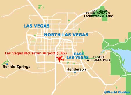
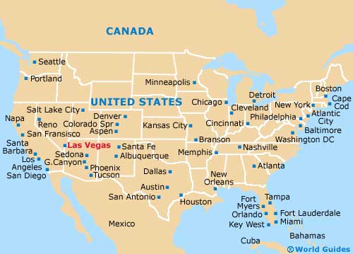
With the city's McCarran International Airport being within such close proximity, Las Vegas offers superb transport connections to the rest of the planet. The unique and extremely characterful city of Las Vegas resides on the far southern side of Nevada, being within reasonable reach of the Arizona and
California state borders.
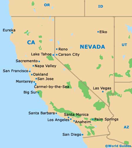
Although Las Vegas may well be the largest city within Nevada, it is
Carson City that functions as the capital. However, it does serve as the county seat of Clark County and far more impressively, as the 'Entertainment Capital of the World'.
Maps and Orientation of the City
Stretching for around 4 miles / 6.5 km in length, the Las Vegas Strip is where all the action happens, forming a centerline for the city. The biggest and brashest hotels all line the Strip, with Circus Circus standing on its northern side and the Mandalay Bay Hotel on its southern side.
It is worth noting that maps often make this busy thoroughfare seem shorter than it actually is, so be sure to leave plenty of time if you are planning to walk between attractions on the Las Vegas Strip, since a simple stroll can often prove to be quite a trek.
- Blue Diamond - 19 miles / 31 km (30 minutes, southwest)
- Caliico Basin - 22 miles / 35 km (35 minutes, west)
- Enterprise - 10 miles / 16 km (20 minutes, southwest)
- Grand Canyon Village - 265 miles / 426 km (six hours, east)
- Henderson - 17 miles / 27 km (25 minutes, southeast)
- Indian Springs - 49 miles / 79 km (one hour and 15 minutes, northwest)
- Mount Charleston - 43 miles / 69 km (one hour and ten minutes, northwest)
- Pahrump - 58 miles / 93 km (one hour and 20 minutes, northwest)
- Paradise - 3 miles / 5 km (ten minutes, southeast)
- Sandy Valley - 46 miles / 74 km (one hour and ten minutes, southwest)
- Spring Mountain Ranch State Park - 22 miles / 35 km (35 minutes, southwest)
- Spring Valley - 5 miles / 8 km (12 minutes, west)
- Summerlin South - 11 miles / 18 km (20 minutes, west)
- Sunrise Manor - 12 miles / 19 km (25 minutes, northeast)
- Whitney - 9 miles / 14 km (18 minutes, east)
- Winchester - 4 miles / 6 km (ten minutes, east)
Map of the United States
Map of Nevada
Map of Las Vegas