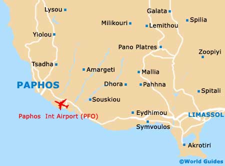
Paphos Maps and Orientation
(Paphos, Cyprus)
Situated on the far south-westerly side of
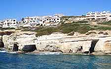
Cyprus, Paphos is a popular island resort, with glorious sandy beaches and endless coastal views. The town is the capital of the actual Paphos District and is roughly split into two main regions.
Lower Paphos is officially named as 'Kato Pafos' and serves as the town's leading tourist resort, being known for its lively nightlife, busy bars and colourful nightspots. Ktima (Upper Pafos) stands some 3 km / 2 miles to the north of Kato Pafos and is the actual genuine center of the town. Having successfully managed to distance itself for the tourist boom, Ktima remains a considerably more tranquil and relaxing spot to visit.
Maps and Orientation of the Town
The two very separate parts of Paphos are connected by a prominent road, named the Leoforos Apostolou Pavlou. For maps and tourist information, there are actually no less than three modern 'Infopoint' touch-screen booths within the town - two on the Posidonos (Poseidonos) in Kato Pafos and one on Ktima's main public square.
Outlets of the Cyprus Tourism Organisation (CTO) are also handy places to pick up good maps of Cyprus, with a convenient branch located at
Paphos International Airport.
- Akarsu - north
- Amarketi - east
- Ayia Napa (Agia Napa / Aya Napa) - far north-east
- Burciu - south-east
- Celocera - north-east
- Drousha - north
- Episkopi - east
- Evdhimou - south-east
- Famagusta (Ammóchostos / Gazimagusa) - far north-east
- Kathikas - north
- Kividhes - east
- Kouklia - south-east
- Kyrenia (Keryneia / Girne) - far north-east
- Larnaca (Larnaka) - far north-east
- Limassol (Lemesos / Limasol / Leymosun) - east
- Mandria - south-east
- Nicosia (Lefkosia) - far north-east
- Pakhna - east
- Paphos Ktima - south
- Peyia - north
- Polis - north
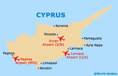
Map of Cyprus
Map of Paphos