Dalian Maps and Orientation
(Dalian, Liaoning, China)
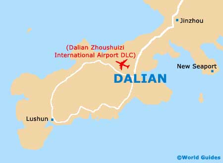
Located on the north-eastern side of China, Dalian is a surprisingly important and wealthy coastal city, situated directly west of North Korea and north-west of South Korea. The Dalian region incorporates the town of Lushun (Port Arthur), which lies to the north and incorporates an impressive natural harbour and the most important port on the whole of the Liaodong Peninsula.
Dalian lies on the western side of the Yellow Sea and on the eastern side of the Bohai Sea / Gulf of Chihli. The city enjoys a fairly central setting on Liaodong itself, where the peninsula is particularly narrow and scenic.
Maps and Orientation of the City
Dalian boasts a stunning coastline and is surrounded by more than 200 small islands and appealing reefs. Highlights around the city include the meandering Yalu River, which is sited to the north, and also the city's prominent harbour area, often referred to as Dalian Bay.
When visiting Dalian, a folding English-language map will become an essential travel item and is usually available at the Travel Agencies around the city. Some basic maps are also available at the largest hotels and bookstores, including the Xinhua Bookshop along Tongxing Jie, although most are in Chinese.
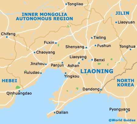
The following towns and cities are nearby and shown below with relevant directions in relation to the city of Dalian.
- Anshan - north
- Dandong - north-east
- Dawa - north
- Lushun - south-west
- Jinzhou - north
- Pyongyang - east
- Shenyang - north-east
- Tangshan - west
- Tianjin - west
- Wafangdian - north
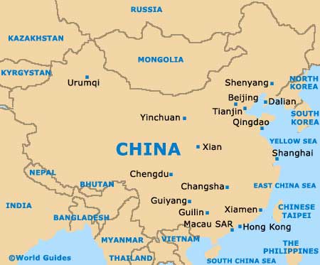
Map of China
Map of Liaoning
Map of Dalian