Philadelphia Maps and Orientation
(Philadelphia, Pennsylvania - PA, USA)
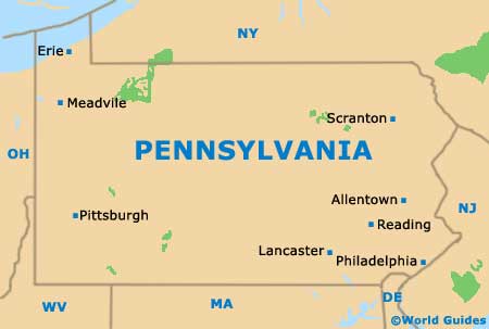
The biggest city within the whole of the Commonwealth of Pennsylvania, Philadelphia is also the seat of the county of the same name. Located alongside both the Delaware River and the Schuylkill River, on the far southeastern side of the state, Philadelphia lies next to the border with
New Jersey and within relatively close proximity to
Delaware.
Visitors will generally find that Philadelphia is easy to get around, with many of the principal tourist attractions, museums and hotels being reachable on foot. All of the streets heading in an east to west direction have been named, while those heading north to south are generally known by numbers.
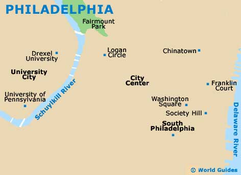
The historic heart of Philadelphia comprises the Old City, the Independence National Historic Park and waterfront areas. Head directly to the east and you will soon encounter the Center City neighborhood and its notable landmarks, namely the City Hall and Penn Square.
Maps and Orientation of the City
South Philadelphia is edged by the rivers and comes with various eateries and bars, along with the Italian Market. To the west, the University City features no less than two spreading campuses.
Maps of Philadelphia are available from most good hotels and gift shops, as well as at the Independence Visitor Center on Market Street, where the Greater Philadelphia Tourism Marketing Corp is also to be found sharing office space.
- Chester - 15 miles / 24 km (30 minutes, southwest)
- Claymont - 21 miles / 34 km (35 minutes, southwest)
- Doylestown - 38 miles / 61 km (one hour, north)
- Glenside - 12 miles / 19 km (25 minutes, north)
- Gloucester Township - 15 miles / 24 km (30 minutes, south)
- Harrison Township - 23 miles / 37 km (40 minutes, south)
- Havertown - 10 miles / 16 km (20 minutes, west)
- Maple Glen - 26 miles / 42 km (45 minutes, north)
- Monroe Township - 26 miles / 42 km (45 minutes, southeast)
- Mount Royal - 16 miles / 26 km (30 minutes, south)
- Newtown Square - 14 miles / 23 km (30 minutes, west)
- Sicklerville - 23 miles / 37 km (40 minutes, southeast)
- Vineland - 48 miles / 77 km (one hour and 15 minutes, south)
- West Chester - 34 miles / 55 km (55 minutes, west)
- Willow Grove - 14 miles / 23 km (30 minutes, north)
- Wilmington - 30 miles / 48 km (50 minutes, southwest)
- Winslow Fish and Wildlife Management Area - 26 miles / 42 km (45 minutes, southeast)
Map of the United States

Map of Pennsylvania
Map of Philadelphia