Berlin Maps and Orientation
(Berlin, Germany)
Regarded as something of a city state, Berlin is the German capital and the country's largest city. Situated on the north-eastern side of Germany and within the European Plains area, the city makes the very heart of the Berlin-Brandenburg Metropolitan Region.
Berlin is a city of culture and politics, whilst also being an important transportation hub and financial centre. Separated by the Spree River, the city lies roughly 60 km / 37 miles from the border with
Poland (east). The history of Berlin has created a city with a diverse and somewhat eclectic assortment of buildings and architectural styles. Following the abolition of the East / West divide in 1989, the city is now unified, although each side still retains an individual character.
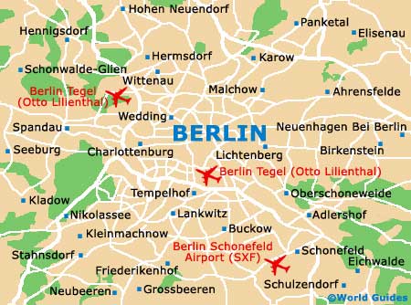
Maps and Orientation of the City
The city of Berlin comprises 12 individual administrative districts. For tourists, the central districts of Charlottenburg / Wilmersdorf, Friedrichshain / Kreuzberg, Mitte, Prenzlauer Berg and Schoneberg are likely to be of most interest. Charlottenburg and Mitte are connected by the enormous Tiergarten Park.
Those planning to navigate the streets of Berlin are advised to head to the Brandenburg Gate tourist office, where free maps are available.
- Cottbus - 129 km / 80 miles (two hours, south-east)
- Dessau - 133 km / 83 miles (two hours, south-west)
- Furstenwalde - 72 km / 45 miles (one hour and ten minutes, east)
- Genthin - 117 km / 73 miles (one hour and 50 minutes, west)
- Halle - 177 km / 110 miles (two hours and 40 minutes, south-west)
- Leipzig - 195 km / 121 miles (three hours, south-west)
- Ludwigsfelde - 33 km / 21 miles (40 minutes, south)
- Magdeburg - 159 km / 99 miles (two hours and 25 minutes, south-west)
- Neuruppin - 82 km / 51 miles (one hour and 20 minutes, north-west)
- Oranienburg - 37 km / 23 miles (40 minutes, north)
- Potsdam - 42 km / 26 miles (45 minutes, south-west)
- Strausberg - 40 km / 25 miles (45 minutes, east)
- Templin - 78 km / 48 miles (one hour and 15 minutes, north)
- Wittenberg - 116 km / 72 miles (one hour and 50 minutes, south)
Map of Germany

Map of Berlin