Perth Maps and Orientation
(Perth, Western Australia - WA, Australia)
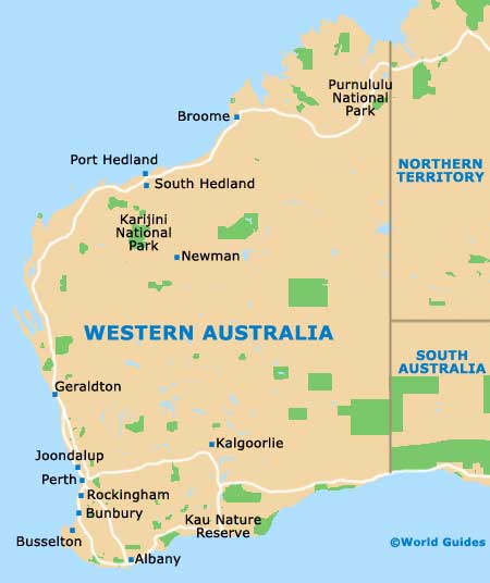
The biggest city within the Western Australia state, Perth is located on the south-westerly side of Australia and close to the coastline. Perth is now home to more than 1.5 million inhabitants and is centred around the Swan River.
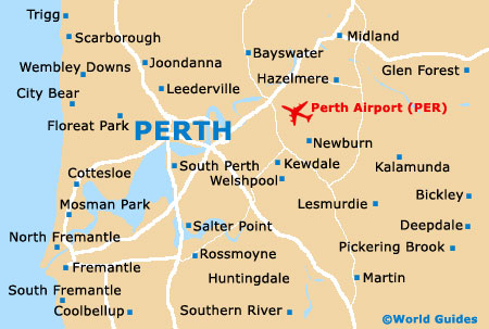
A number of popular beaches surround Perth and add greatly to the tourist appeal of this city, generally remaining uncrowded throughout the year. Perth's Central Business District (CBD) is to be found approximately 10 km / 6 miles inland and on the banks of the Swan River, next to the Northbridge shopping area.
Maps and Orientation of the City
St. George's Terrace marks the very heart of the Central Business District, while shoppers usually head to the various arcades off Hay Street and Murray Street. The western side of Perth slopes upwards and towards Kings Park, from where some exceptional cityscape views are possible.
Maps of Perth are available at the plentiful bookstores along Hay Street and William Street, as well as at the City of Perth information Kiosk on the Murray Street Mall, and at the Western Australian Visitors Centre on Forrest Place.
Map of Australia

Map of Western Australia
Map of Perth