San Francisco Maps and Orientation
(San Francisco, California - CA, USA)
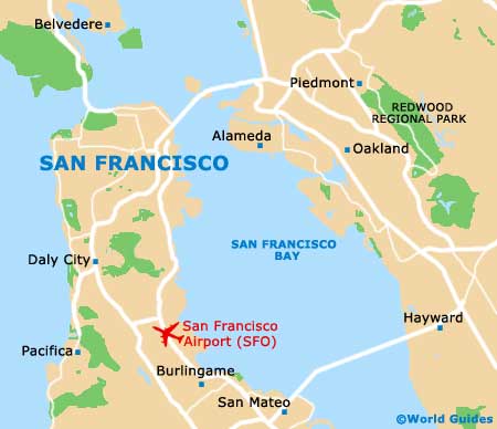
One of the most famous and most hilly cities located within the state of California, San Francisco is actually both a city and a county, merged to create just one area (a 'consolidated city county'). However, most people generally refer to San Francisco as a city.
Located on the northwestern coastline of California, San Francisco is especially close to
Oakland, which is located to the east. These two cities are connected by the San Francisco - Oakland Bay Bridge (Interstate I-80).
The Angel Island State Park lies directly to the north of downtown San Francisco, with the San Bruno Mountain State Park being situated to the south and the Golden Gate National Recreational Area to the northwest, just above the Richmond District.
Maps and Orientation of the City
Maps will certainly help you find your way around San Francisco and its 40+ hills. The dimensions of this very square-shaped city are roughly 7 miles / 11 km by 7 miles / 11 km, meaning that many of the principal attractions can often be reached on foot.
Much of San Francisco city center is organized as a giant intersecting grid of avenues (north to south / east to west), although Market Street is the exception and heads in a diagonal direction through these streets, northeast to southwest. For historical sights, the Mission area is a safe bet, while next-door, the South of Market District (SoMa) is known for its converted warehouses and trendy eateries. Other interesting parts of the city include Union Square, Civic Center, Fisherman's Wharf, Nob Hill and North Beach.
- Big Sur - 148 miles / 238 km (two hours and 50 minutes, south)
- Carmel by the Sea - 122 miles / 196 km (two hours and 30 minutes, south)
- Daly City - 10 miles / 16 km (15 minutes, south)
- Golden Gate National Recreation Area - 9 miles / 14 km (15 minutes, north)
- Half Moon Bay - 29 miles / 47 km (45 minutes, south)
- Monterey - 112 miles / 180 km (two hours and 20 minutes, south)
- Mountain View - 39 miles / 63 km (55 minutes, southeast)
- Napa Valley - 45 miles / 72 km (one hour, north)
- Novato - 28 miles / 45 km (40 minutes, north)
- Oakland - 12 miles / 19 km (25 minutes, east)
- Sacramento - 88 miles / 142 km (two hours and five minutes, northeast)
- San Jose - 48 miles / 77 km (one hour and 15 minutes, southeast)
- San Mateo - 19 miles / 31 km (25 minutes, south)
- San Rafael - 18 miles / 29 km (25 minutes, north)
- San Ramon - 34 miles / 55 km (50 minutes, east)
- Sunnyvale - 40 miles / 64 km (55 minutes, southeast)
- Tamalpais Homestead Valley - 13 miles / 21 km (20 minutes, north)
- Walnut Creek - 25 miles / 40 km (35 minutes, northeast)
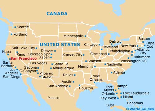
Map of the United States
Map of California

Map of San Francisco