Winnipeg Maps and Orientation
(Winnipeg, Manitoba - MB, Canada)
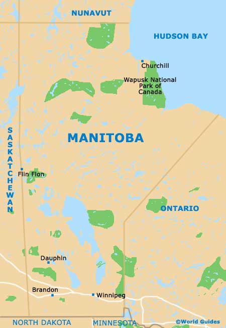
With a population soon expected to reach 700,000 people, the city of Winnipeg is located within the province of Manitoba (MB), on the southerly side of Canada and close to the Ontario province. Winnipeg lies to the south-east of
Calgary and in the Red River Valley, next to the meeting point of the Assiniboine River and the Red River.
The city can be found on the eastern side of the Canadian Prairies and is especially close to the border with North America, being part of the Winnipeg Capital Region, where it has grown to become both the economic center and capital city. Winnipeg is divided into a series of districts and comprises more than 200 different neighborhoods.
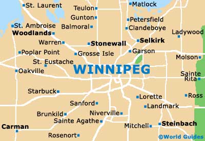
Maps and Orientation of the City
Downtown Winnipeg is around 1 square mile / 2.5 square kilometers, with numerous urban developments surrounding the city center and following the rivers. Other notable parts of the city include the Exchange District, Chinatown, Old Saint Boniface and The Forks.
For maps of Winnipeg, travel and tourism outlets can be found along Broadway Avenue, Forks Market Road and Portage Avenue.
Map of Canada

Map of Manitoba
Map of Winnipeg