Cologne Maps and Orientation
(Cologne, North Rhine-Westphalia, Germany)
A huge city that has grown to become the biggest in the whole of the North Rhine Westphalia region, Cologne is currently Germany's fourth-largest city, boasting a population exceeding one million. Cologne is a particularly historic city, being founded some 2,000 years ago, and is centred around the Rhine River, which has brought it much prosperity over the years.
The city of Cologne has long been the true cultural capital of Germany's Rhineland area and is home to many important media companies, with the country' television industry contributing to its ever increasing wealth. As a result, many high-rise buildings and office blocks have sprung up in many parts of Cologne, particularly around the downtown district, where the KolnTurn is extremely eye-catching.
This striking piece of contemporary architecture dominates the city's Neustadt-Nord district and towers to almost 150 metres / 492 feet. Another particularly breathtaking landmark in the Ehrenfeld area of Cologne is the Colonius telecommunications tower, the city's tallest structure and a useful point of reference.
Maps and Orientation of the City
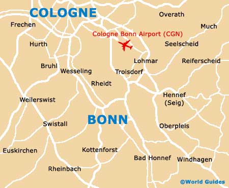
Outside of the city are many important locations and transport hubs. Particularly notable is the Koln-Bonn Airport, which lies to the south-east of the city, while the Hauptbahnhof train station stands within the city itself, on the western bank of the Rhine. The following locations are all especially close to Cologne and can be reached by most modes of public transport, including buses and trains.
- Bergheim - 34 km / 21 miles (30 minutes, west)
- Bergisch Gladbach - 19 km / 12 miles (20 minutes, north-east)
- Bonn - 30 km / 19 miles (30 minutes, south-east)
- Bornheim - 26 km / 16 miles (25 minutes, south)
- Brühl - 18 km / 11 miles (20 minutes, south-west)
- Dusseldorf - 37 km / 23 miles (30 minutes, north)
- Frechen - 14 km / 9 miles (18 minutes, west)
- Hürth - 10 km / 6 miles (15 minutes, south-west)
- Leverkusen - 19 km / 12 miles (20 minutes, north)
- Neuss - 37 km / 23 miles (30 minutes, north-west)
- Pulheim - 16 km / 10 miles (18 minutes, north-west)
- Remscheid - 46 km / 29 miles (40 minutes, north-east)
- Solingen - 42 km / 26 miles (40 minutes, north)
- Wesseling - 16 km / 10 miles (15 minutes, south)
Map of Germany

Map of Cologne