Santa Barbara Maps and Orientation
(Santa Barbara, California - CA, USA)
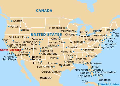
Located in the southerly portion of California and alongside the Pacific coast, the city of Santa Barbara is just over two hours away from both
Los Angeles and
Santa Monica. Santa Barbara is to be found within the county of the same name, where it serves as the county seat, although Santa Maria is actually the county's biggest city.
The city's coastal setting offers some spectacular scenery and beaches, while the inland Santa Ynez Mountains provide an impressive backdrop with their peaks of more than 1,200 metres / 3,940 feet.
Following a severe earthquake in 1925, much of the city center was damaged and destroyed. Rebuilding work followed soon after the debris was cleared, with buildings being strongly influenced by traditional Spanish Colonial Revival designs. This style of architecture is still clearly visible today, meaning that Santa Barbara boasts an interesting and rather distinctive character.
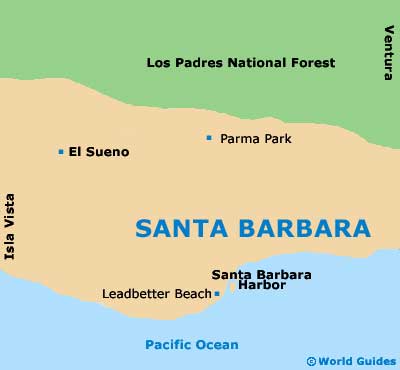
Maps and Orientation of the City
Maps of the city are available at the Santa Barbara Visitors Center, which is located on the corner of Garden Street and the East Cabrillo Boulevard, being close to the Casa Las Palmas and featuring its very own car park.
From here, the Stearns Wharf is less than ten minutes away by foot, via the West Cabrillo Boulevard, known for its numerous eateries.
- Agoura Hills - 61 miles / 98 km (one hour and 30 minutes, southeast)
- Anaheim - 120 miles / 193 km (three hours, southeast)
- Bakersfield - 147 miles / 237 km (three hours, north)
- Big Sur - 210 miles / 338 km (three hours and 45 minutes, northwest)
- Carmel by the Sea - 252 miles / 406 km (four hours and 15 minutes, northwest)
- Lompoc - 54 miles / 87 km (one hour and ten minutes, northwest)
- Los Angeles - 95 miles / 153 km (two hours and 20 minutes, southeast)
- Los Padres National Forest - 65 miles / 105 km (one hour and 40 minutes, north)
- Maricopa - 103 miles / 166 km (two hours and 30 minutes, north)
- Oxnard - 38 miles / 61 km (55 minutes, southeast)
- Palmdale - 118 miles / 190 km (two hours and 50 minutes, east)
- San Buenaventura - 34 miles / 55 km (45 minutes, southeast)
- San Luis Obispo - 106 miles / 171 km (two hours and 30 minutes, northwest)
- Santa Clarita - 78 miles / 126 km (two hours, east)
- Santa Maria - 75 miles / 121 km (one hour and 55 minutes, northwest)
- Santa Monica - 92 miles / 148 km (two hours and 15 minutes, east)
- Thousand Oaks - 56 miles / 90 km (one hour and 20 minutes, southeast)
Map of the United States
Map of California

Map of Santa Barbara