Alicante Maps and Orientation
(Alicante, Costa Blanca, Spain)
Located on the southern side of Spain's Valencian Community, Alicante is the capital city of the Alicante Province. A historic and busy port city, visitors choosing to base themselves within the Old Town will find that the majority of the attractions are within comfortable walking distance, although buses and trams are in good supply.
Running alongside the harbourfront, the Paseo Explanada de Espana is a popular and scenic promenade, being traffic-free and lined with mature palm trees. Many tourists holidaying in Alicante find that the Catedral de San Nicolás de Bar on the Plaza Abad Penalva is a useful reference point, being surrounded by the numerous narrow alleyways and streets that combine to make up the Old Quarter (El Barrio).
Maps and Orientation of the City
The El Barrio district is known for its cheap hotels, lively nightspots and tempting restaurants. Edging El Barrio is the busy north to south thoroughfare - the Rambla de Méndez Núnez, which connects the Plaza San Cristobal and the Calle de San Vincente. The tourist office based on the Rambla de Méndez Núnez is a good place to come for sightseeing advice and to pick up free Alicante maps.
- Albacete - 168 km / 104 miles (two hours and 45 minutes, north-west)
- Almansa - 97 km / 60 miles (one hour and 35 minutes, north)
- Benidorm - 46 km / 29 miles (50 minutes, north-east)
- Cartagena - 123 km / 76 miles (two hours, south-west)
- Castellon de la Plana - 263 km / 163 miles (four hours, north-east)
- Ciudad Real - 384 km / 239 miles (five hours and 30 minutes, west)
- El Campello - 13 km / 8 miles (20 minutes, north-east)
- Elche - 26 km / 16 miles (30 minutes, south-west)
- Granada - 350 km / 217 miles (five hours and 15 minutes, south-west)
- Madrid - 432 km / 268 miles (six hours and 30 minutes, north-west)
- Murcia - 82 km / 51 miles (one hour and 20 minutes, south-west)
- Torrevieja - 78 km / 48 miles (one hour and 20 minutes, south-west)
- Valencia - 178 km / 111 miles (three hours, north-east)
- Yecia - 60 km / 37 miles (one hour and five minutes, north-west)
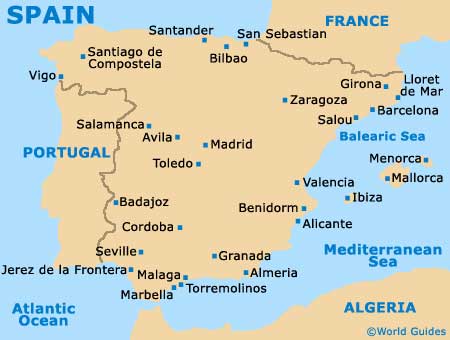
Map of Spain

Map of Alicante


