Stoke on Trent Maps and Orientation
(Stoke on Trent, Staffordshire, England, UK)
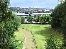
Generally described as a city, Stoke on Trent is actually made up of no less than six individual towns, those of Burslem, Fenton, Hanley, Longton, Stoke and Tunstall. The towns roughly line the A50 road, with Hanley generally being acknowledged as the centre of modern-day Stoke on Trent.
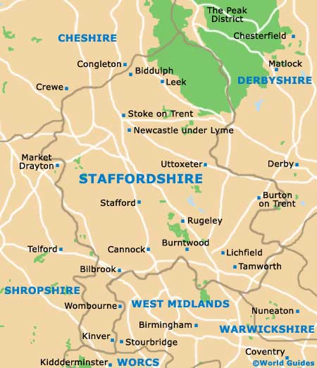
Located on the northerly side of Staffordshire county and in north-western
England, Stoke on Trent is to be found sandwiched between
Birmingham (south) and
Manchester (north). The scenic and spreading Peak District lies to the north-east and includes an area of the Staffordshire Moorlands District, together with chunks of Derbyshire, Greater Manchester and also South Yorkshire.
Maps and Orientation of the City
Visitors arriving by train will find that the railway station is situated just a short distance to the south of Hanley. Informative maps of Stoke on Trent are available at the railway station, as well as the Tourist Information Centre in Hanley, which stands on Quadrant Road, within the Potteries Shopping Centre.
- Ashbourne - 37 km / 23 miles (40 minutes, east)
- Birmingham - 77 km / 48 miles (one hour and ten minutes, south)
- Buxton - 37 km / 23 miles (40 minutes, north-east)
- Cannock - 51 km / 32 miles (45 minutes, south)
- Chester - 85 km / 53 miles (one hour and 15 minutes, north-west)
- Congleton - 22 km / 14 miles (25 minutes, north)
- Coventry - 104 km / 65 miles (one hour and 25 minutes, south-east)
- Crewe - 22 km / 14 miles (25 minutes, north-west)
- Derby - 59 km / 37 miles (one hour, east)
- Leek - 16 km / 10 miles (22 minutes, north-east)
- Leicester - 101 km / 63 miles (one hour and 25 minutes, south-east)
- Liverpool - 91 km / 57 miles (one hour and 15 minutes, north-west)
- Macclesfield - 35 km / 22 miles (40 minutes, north)
- Manchester - 85 km / 53 miles (one hour and 15 minutes, north)
- Market Drayton - 27 km / 17 miles (30 minutes, south-west)
- Nantwich - 27 km / 17 miles (30 minutes, west)
- Newcastle under Lyme - 5 km / 3 miles (eight minutes, south-west)
- Nottingham - 88 km / 55 miles (one hour and 15 minutes, east)
- Ripley - 75 km / 47 miles (one hour and ten minutes, east)
- Sheffield - 78 km / 49 miles (one hour and 15 minutes, north-east)
- Shugborough - 40 km / 25 miles (40 minutes, south)
- Shrewsbury - 59 km / 37 miles (one hour, south-west)
- Stafford - 32 km / 20 miles (35 minutes, south)
- Stockport - 69 km / 43 miles (one hour and five minutes, north)
- Tamworth - 76 km / 47 miles (one hour and five minutes, south-east)
- Telford - 72 km / 45 miles (one hour and five minutes, south-west)
- Uttoxeter - 29 km / 18 miles (30 minutes, south-east)
- Walsall - 61 km / 38 miles (one hour, south)
- Wolverhampton - 61 km / 38 miles (one hour, south)
Map of the United Kingdom

Map of Staffordshire
Map of Stoke on Trent

