London Maps and Orientation
(London, England, UK)
The city of London is simply enormous are for many, quite overwhelming. London is more like a large collection of towns than one big city, and features a series of underground trains, which connect all of the main districts. These London districts include Chelsea, Fulham, Hackney, Hammersmith, Kensington, Notting Hill, Richmond, Southwark, Westminster and the West End (Covent Garden, Leicester Square, Oxford Street and Piccadilly Circus).
Visitors will find that the River Thames is certainly the main geographical feature of this metropolis and meanders its way through the very heart of the city, where it is lined with world-famous attractions, such as the Houses of Parliament, the Tower of London, St. Paul's Cathedral and the London Eye. The River Thames roughly divides the city into two main regions (north and south) and is spanned by a number of iconic bridges, including both Tower Bridge and the somewhat contemporary Millennium Footbridge.
Maps and Orientation of the City
Whether you are planning to find your way around on foot, by bus or by tube train, maps of London are essential and quite varied in size, quality and price. Maps can be purchased all around the city centre, with tourist-themed souvenir shops offering plenty of choice. Many guide books also contain simple pull-out maps of the city and the underground train network.
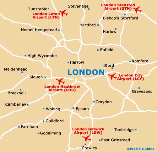
Map of the United Kingdom

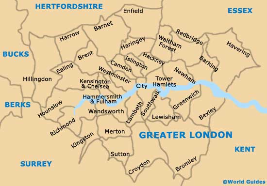
Map of Greater London
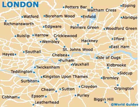
Map of London