Poole Maps and Orientation
(Poole, Dorset, England, UK)
One of the most visited of all the towns and coastal resorts in Dorset, Poole has long been an important seaport and enjoys a scenic spot on the southern coast of England. Poole is especially close to
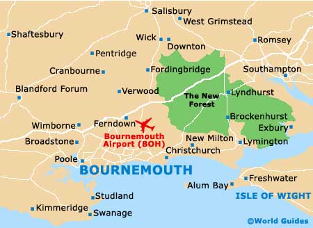
Bournemouth, Boscombe and Christchurch, all of which lie to the east.
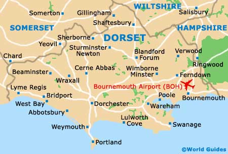
A little further away, although still within easy reach of Poole, you will find Dorchester (west), the
Isle of Wight (south-east), the New Forest National Park (north-east), Portsmouth (east),
Salisbury (north-east),
Southampton (north-east), Swanage (south) and also
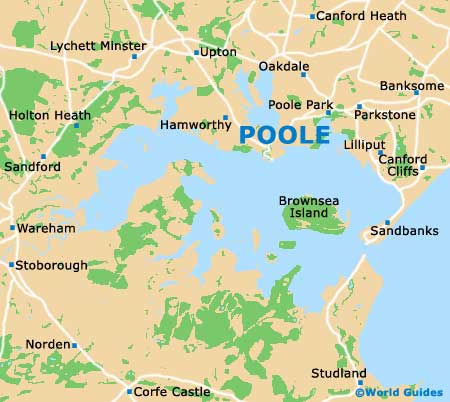
Weymouth (south-west). Tourists often favour a short excursion across Poole Harbour, to see the famous red squirrels on the National Trust reserve of Brownsea Island.
Maps and Orientation of the City
Shops, restaurants and bars are scattered around the harbourfront and this part of Poole really is best covered on foot. However, if you are planning to drive out of town and explore Dorset, then maps can be obtained at most newsagents and at the Tourist Information Centre (TIC) on the High Street, close to the quay.
Map of the United Kingdom

Map of Dorset
Map of Poole Area
Map of Poole