Larnaca Maps and Orientation
(Larnaca, Cyprus)
Part of the island's Larnaca District and enjoying a fairly central location on the south coast of
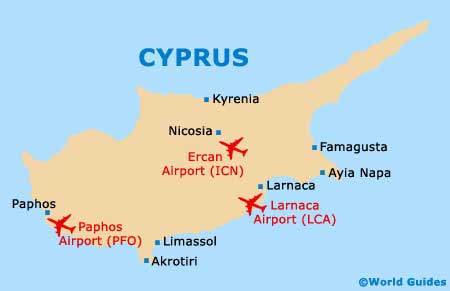
Cyprus, Larnaca is a busy city and tourist destination. The popularity of the city is not only due to its scenic seaside setting and plentiful beaches, but also to the fact that it is home to the island's biggest airport -
Larnaca International Airport, which stands just 5 km / 3 miles from the city centre and is therefore just a matter of minutes away.
Larnaca is also where you will find the island's number two commercial port and a large marina area. Life in the city often revolves around the promenade, especially at times of celebrations.
Maps and Orientation of the City
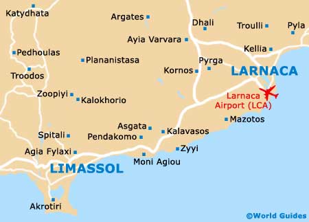
The city centre is relatively compact and easy to navigate, with the majority of attractions and facilities being just a short walk from centrally located hotels and transportation terminals. Central Larnaca is bounded by four main roads, the Leoforos Athinon (east), the Leoforos Artemidos (west), the Leoforos Faneromenis (south), and the Leoforos Grigoriou Afxentiou (north).
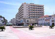
The paved street of Leoforos Athinon is lined with mature palm trees and is regularly frequented by tourists visiting Larnaca, being best known as the Palm Tree Promenade (Finikoudes / Phinikoudes). This area forms part of the main tourist and business district, while to the south and next to the seafront is the area that was formerly the Turkish district. Both the Larnaka Fort and the Grand Mosque can be found here. For maps of Larnaca and Cyprus, and general tourist advice, head to the Cyprus Tourism Organisation (CTO) outlet on the Plateia Vasileos Pavlou.
- Athienou - north-west
- Ayia Napa (Agia Napa / Aya Napa) - north-east
- Choirokoitia - south-west
- Famagusta (Ammóchostos / Gazimagusa) - north-east
- Goshi - north-west
- Khorno - north-west
- Kilrou - north-west
- Kiti - south-west
- Kochati - north-west
- Kophinou - south-west
- Kyrenia (Keryneia / Girne) - far north-west
- Lefkara - west
- Limassol (Lemesos / Limasol / Leymosun) - far south-west
- Lythrodhonda - north-west
- Marki - north-west
- Mazotos - south-west
- Nicosia (Lefkosia) - north-west
- Pana Kophinou - south-west
- Paphos (Pafos / Paphus) - far south-west
- Pera - north-west
- Politiko - north-west
- Scala - south
- Sha - north-west
- Troulli - north
Map of Cyprus
Map of Larnaca