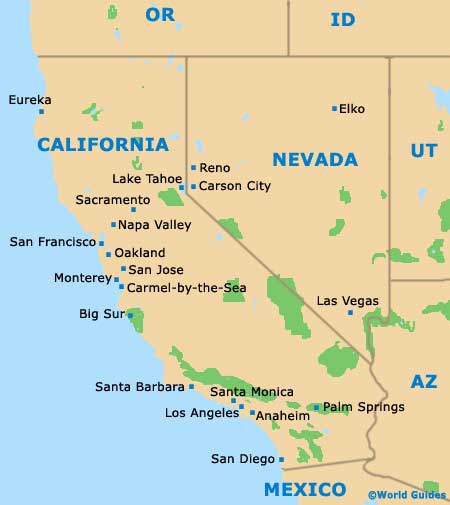
Sacramento Maps and Orientation
(Sacramento, California - CA, USA)
Lying on the northern side of California and within relative proximity to the
Napa Valley area, the city of Sacramento is actually the state capital, despite being somewhat dwarfed by the considerably larger cities of
Los Angeles,
San Diego and
San Jose. In fact, Sacramento is only the six-largest city in California, although it does rank as the state's most historic incorporated city.
The city resides at the very point where the American River meets with the Sacramento River, with its deep harbor enjoying access to the San Francisco Bay via the Sacramento River Delta.
For tourists, it is Old Sacramento that holds the greatest appeal, with its cobblestone streets and historical buildings dating from the middle of the 19th century. Highlights here include the Big Four Building, the BF Hastings Building, the Eagle Theater and also the Lady Adams Building.
Maps and Orientation of the City
If you are trying to find your way around Sacramento, then you may like to obtain maps of the city.
Maps can be found upon your arrival at the
Sacramento International Airport and also at the visitors center along J Street, which is just down the road from the California Peace Officers' Memorial.
- Big Sur - 216 miles / 348 km (four hours and 20 minutes, southwest)
- Carmel by the Sea - 190 miles / 306 km (three hours and 45 minutes, southwest)
- Chico - 87 miles / 140 km (two hours and ten minutes, north)
- Elk Grove - 17 miles / 27 km (25 minutes, south)
- Fairfield - 43 miles / 69 km (one hour, southwest)
- Folsom - 24 miles / 39 km (35 minutes, east)
- Modesto - 76 miles / 122 km (one hour and 40 minutes, south)
- Monterey - 186 miles / 299 km (three hours and 45 minutes, south)
- Napa Valley - 56 miles / 90 km (one hour and five minutes, southwest)
- Oakland - 81 miles / 130 km (two hours, southwest)
- Rancho Cordova - 14 miles / 23 km (20 minutes, east)
- San Francisco - 88 miles / 142 km (two hours and five minutes, southwest)
- San Jose - 118 miles / 190 km (two hours and 40 minutes, south)
- Santa Rosa - 98 miles / 158 km (two hours and 20 minutes, west)
- South Lake Tahoe - 105 miles / 169 km (two hours and 30 minutes, northeast)
- Yuba City - 4 miles / 6 km (ten minutes, north)
Map of the United States

Map of California

Map of Sacramento


