Tampere Maps and Orientation
(Tampere, Pirkanmaa, Western Finland, Finland)
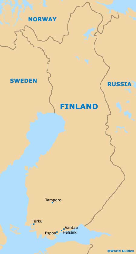
The Finnish city of Tampere can be found within the Pirkanmaa area and to the south of Finland. Located either side of Tampere are two large lakes, the Pyhäjärvi and also the Näsijärvi, both of which have become important local landmarks.
Founded in the late 18th century, in recent years, the population of Tampere has now exceeded 200,000 and the city is amongst the most important in the country, being Finland's third biggest. Interestingly, Tampere is also the largest inland city within the whole of the Nordic region and Scandinavia, which comprises
Finland and also counties such a
Denmark,
Iceland,
Sweden and
Norway.
Maps and Orientation of the City
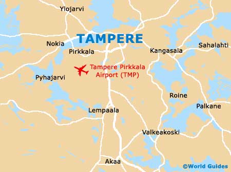
Many interesting municipalities and suburbs surround Tampere and Kangasala is particularly notable, being known for its healing spring (Kuohu / Kuohunlähde) and natural beauty. Also nearby and around 15 km / 9 miles west of Tampere, Nokia is a small and interesting town and lies next to the Nokianvirta River. Here you can expect to find a number of attractive waterways and many seasonal events.
Tampere is sited some 170 km / 106 miles to the north of
Helsinki and is easy to reach. When venturing outside of the city by car, it is always sensible to use a good fold-up map.
- Aitoniemi - north
- Asema - east
- Hirvenniemi - north-east
- Kämmenniemi - north
- Kulju - south
- Lempäälä - south
- Moisio - south
- Nokia - west
- Paavola - north
- Pirkkala - west
- Sääksjärvi - south
- Säijä - south-west
- Siivikkala - north-west
- Teisko - north
- Vuorentausta - north-west
- Ylöjärvi - north-west
Map of Finland
Map of Tampere