Coventry Maps and Orientation
(Coventry, West Midlands, England, UK)
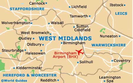
Coventry enjoys a fairly central position in England, in an area of central West Midlands known as the West Midlands. One of the largest and most densely populated cities in the whole of the English Midlands, Coventry is close to many major cities and connected by a series of motorways, which include the M1, M5, M6, M40 and M45, together with numerous 'A' roads, such as the A5, A45, A46, A423, A428, A444 and A452.
The city of Coventry is surrounded by a ring road, which includes the A4053 and Ringway Hill Cross, Ringway St. Nicholas, Ringway Swanswell, Ringway Whitefriars, Ringway St. John's, Ringway St. Patrick's, Ringway Queens and Ringway Rudge. Prominent thoroughfares in the city centre include Corporation Street, Greyfriars Road, High Street, New Union Street and Queen Victoria Road, which passes the Skydome Odeon Complex, Planet Ice Arena, the City Arcade and the Coventry Retail Market.
Maps and Orientation of the City
Although there are plenty of things to do within the city of Coventry itself, nearby excursions and day trips are extremely popular, with so much nearby worth exploring. The main cities, distance, directions and journey times are as follows:
- Bedworth - 11 km / 7 miles (15 minutes, north)
- Bickenhill - 18 km / 11 miles (18 minutes, west)
- Birmingham - 37 km / 23 miles (30 minutes, north-west)
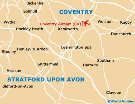
- Kenilworth - 14 km / 9 miles (15 minutes, south-west)
- Leamington Spa - 16 km / 10 miles (20 minutes, south)
- Leicester - 40 km / 25 miles (40 minutes, north-east)
- London - 156 km / 97 miles (one hour and 45 minutes, south-east)
- Nuneaton - 16 km / 10 miles (15 minutes, north)
- Oxford - 89 km / 55 miles (one hour and five minutes, south)
- Rugby - 26 km / 16 miles (25 minutes, east)
- Sandwell - 47 km / 29 miles (40 minutes, north-west)
- Solihull - 24 km / 15 miles (25 minutes, west)
- Stratford upon Avon - 31 km / 19 miles (25 minutes, south-west)
- Warwick - 19 km / 12 miles (20 minutes, south-west)
Map of the United Kingdom

Map of West Midlands
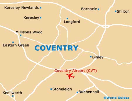
Map of Coventry