Cheltenham Maps and Orientation
(Cheltenham, Gloucestershire, England, UK)
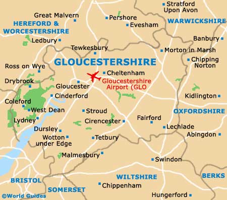
The spreading spa town of Cheltenham is located within the county of Gloucestershire and is now called home by more than 100,000 residents. Standing alongside the Cotswolds and particularly close to Cirencester and Stroud, Cheltenham is an eminently walkable town, dissected in an east to west direction by its High Street.
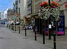
Directly south and within the town centre itself is the Promenade, a further prominent street standing in front of the bus station. The Promenade forms the very heart of Cheltenham and is especially attractive during the summer months, when it is filled with flowers and seasonal hanging baskets.
Maps and Orientation of the City
The Tourist Information Centre (TIC) resides on the Promenade and is a good source of town maps, while nearby are the Municipal Offices and an eye-catching statue of Edward Wilson, a famous Cheltenham local who joined Captain Scott's somewhat ill-fated journey to the South Pole.
From the Promenade, as you head towards the lively Montpellier area of Cheltenham, you will encounter the beautiful Imperial Gardens, and soon after the slightly larger Montpellier Gardens, both of which offer important green recreational spaces in the town centre.
- Bath - 88 km / 55 miles (one hour and ten minutes, south-west)
- Birmingham - 96 km / 60 miles (one hour and ten minutes, north)
- Bourton-on-the-Water - 24 km / 15 miles (30 minutes, east)
- Bredon - 21 km / 13 miles (25 minutes, north
- Bristol - 69 km / 43 miles (55 minutes, south-west)
- Brockworth - 10 km / 6 miles (15 minutes, south-west)
- Cirencester - 24 km / 15 miles (30 minutes, south)
- Coventry - 83 km / 52 miles (one hour and 15 minutes, north-east)
- Evesham - 26 km / 16 miles (30 minutes, north-east)
- Frome - 109 km / 68 miles (one hour and 30 minutes, south-west)
- Gloucester - 13 km / 8 miles (20 minutes, south-west)
- Leicester - 149 km / 93 miles (one hour and 50 minutes, north-east)
- London - 176 km / 110 miles (two hours and 15 minutes, south-east)
- Malmesbury - 46 km / 29 miles (50 minutes, south)
- Milton Keynes - 115 km / 72 miles (two hours, east)
- Nottingham - 168 km / 105 miles (two hours, north-east)
- Oxford - 66 km / 41 miles (one hour, south-east)
- Solihull - 86 km / 54 miles (one hour and ten minutes, north)
- Stratford upon Avon - 50 km / 31 miles (55 minutes, north-east)
- Stroud - 22 km / 14 miles (30 minutes, south-west)
- Swindon - 48 km / 30 miles (50 minutes, south-east)
- Tetbury - 43 km / 27 miles (45 minutes, south-west)
- Tewkesbury - 16 km / 10 miles (18 minutes, north)
- Weston Super Mare - 96 km / 60 miles (one hour and 15 minutes, south-west)
- Wootton Bassett - 48 km / 30 miles (50 minutes, south)
Map of the United Kingdom

Map of Gloucestershire
Map of Cheltenham

