Osaka Maps and Orientation
(Osaka, Kansai, Southern-Central Honshu, Japan)
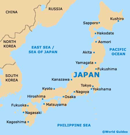
A major city in the heart of the Kansai region, Osaka is the capital city and is located within the prefecture of the same name, on the island of Honshu. The city is a true mixture of huge high-rise buildings and modern developments, which contrast sharply with many surrounding areas of natural beauty, such as both Osaka Bay and the Yodo River. The tallest buildings in the city include the World Trade Centre, the Osaka Bay X-Tower and also the highly acclaimed Umeda Sky Building.
The many skyscrapers quickly changed the cityscape as the city bounced back following the bombings of WWII. Beneath these dominant structures you will find plenty of historical interest, including temples and shrines.
Maps and Orientation of the City
Osaka is an enormous metropolis and densely populated, factors which can make getting around the city appear a little daunting. However, this needn't be the case, since the city's transport infrastructure is excellent and taxis are never far away. At the main visitors centres, you are able to obtain a free copy of the exceptional 'Osaka City Map', which also contains handy inset maps of both the subway system and also the main districts.
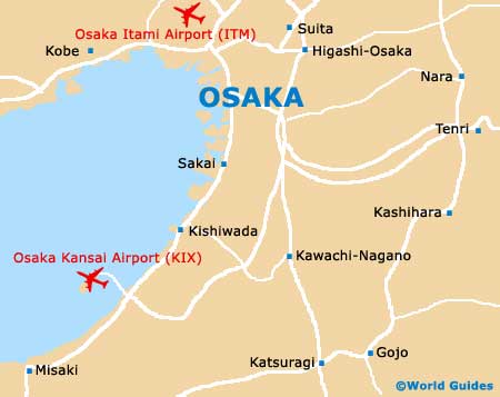
The city proper is divided into two main regions, the northern Kita area and the southern Minami district. Kita contains many of the main business and office blocks in Osaka, while for entertainment, shopping, restaurants, nightclubs and tourist attractions, Minami is the place to be. Guided tours are always available if you would like to be taken around the most important parts of the city by experienced English-speaking locals.
The following locations are all relatively close to Osaka and many have become popular tourist destinations in their own right.
- Higashi-Osaka - north-east
- Hirakata - north-east
- Ibaraki - north
- Kashihara - south-east
- Kawachi-Nagano - south
- Kishiwada - south
- Kobe - west
- Kyoto - north-east
- Maizuru - north
- Nagoya - north-east
- Sakai - south
- Suita - north
- Takarazuka - north-west
- Tenri - east
- Toyonaka - north
Map of Japan
Map of Osaka