Sharm el Sheikh Maps and Orientation
(Sharm el Sheikh, Egypt)
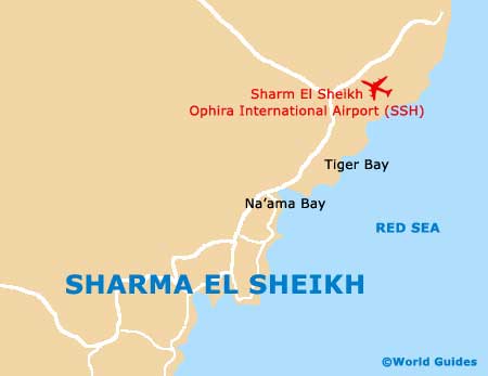
Known for its stunning underwater scenery and beautifully clear waters of the neighbouring Red Sea, the city of Sharm el Sheikh is an important administrative centre for this part of Egypt. Home to a series of holiday resorts, the main tourist hotspots in Sharm el Sheikh are based around its two scenic bays, Sharm al-Maya and Na'ama Bay, two areas which have been extensively developed with tourism in mind.
Maps and Orientation of the City
Na'ama Bay lies amidst the heart of the action in Sharm el Sheikh and is often brimming with pedestrians heading to the beachfront. A notable coastal promenade lies in this area and is lined with many large hotels, eateries and shopping centres. Away from this extremely busy strip, the regions become quieter, with the resorts located on the northern side of Na'ama Bay offering a more peaceful location.
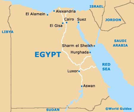
Around 6 km / 4 miles to the west of Na'ama Bay you will find the Sharm al-Maya area of Sharm el Sheikh, which is centred around a popular local market. The harbour stands to the south-west, while the Hadaba district is situated on the top of the cliff and contains a number of fairly middle of the road resorts. Further afield, the following towns and villages are all within reach of Sharm el Sheikh.
- Dahab
- Gebeil
- Jabal Samra
- Jabal Umm Barqah
- Na'amifa
- Naama
- Nabq
- Nebk
- Ofira
- Tur
Continent Map of Africa

Map of Egypt
Map of Sharm el Sheikh