Nashville Maps and Orientation
(Nashville, Tennessee - TN, USA)
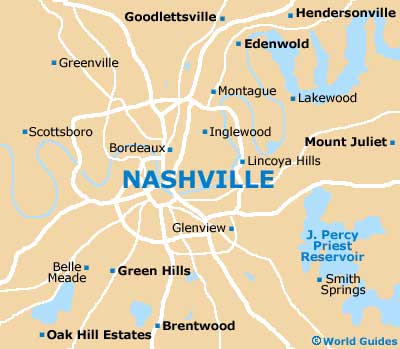
Nashville, the capital of the state of Tennessee, is also the county seat (administrative center) of Davidson County. The State Capitol on Charlotte Avenue resides at Nashville's highest point, ensuring that it is in a prominent setting for all to see and admire, while the very center is bounded to the east by the Cumberland River.
A number of sizeable bridges span the Cumberland, such as the Gateway Boulevard (Korean Veterans Boulevard), Main Street, Woodland Street and the Shelby Street Pedestrian Bridge.
The centrally located 'District' is packed with eateries and shopping opportunities, being sited within downtown Nashville and intersected by Broadway (east to west), as well as both 1st Avenue North and 8th Avenue North (north to south). The US Courthouse, the Greyhound Bus Station and Howell Park are all located within this part of the city.
Maps and Orientation of the City
The downtown district is relatively compact and full of interest for visitors, gently sloping southwards to Broadway, while the Briley Parkway is a thoroughfare of note, heading out of northern Nashville. You may also like to check out Music Row within the lively West End, and perhaps the suburban zone known as Music Valley, to the northeast of the downtown district, where the Grand Ole Opry House is to be found.
Free maps are available at the Nashville Visitor Information Center, where you can also talk to staff about how to best find your way around the city.
- Ashland City - 24 miles / 39 km (40 minutes, northwest)
- Brentwood - 11 miles / 18 km (20 minutes, south)
- Cedars of Lebanon State Park - 39 miles / 63 km (one hour and five minutes, east)
- Chattanooga - 133 miles / 214 km (three hours, southeast)
- Cheatham Wildlife Management Area - 29 miles / 47 km (50 minutes, west)
- Fairview - 33 miles / 53 km (55 minutes, southwest)
- Franklin - 21 miles / 34 km (35 minutes, south)
- Gallatin - 28 miles / 45 km (45 minutes, northeast)
- Green Hill - 15 miles / 24 km (25 minutes, east)
- Hendersonville - 17 miles / 27 km (30 minutes, northeast)
- Hermitage - 11 miles / 18 km (20 minutes, east)
- Long Hunter State Park - 24 miles / 39 km (40 minutes, east)
- Madison - 9 miles / 14 km (15 minutes, north)
- Millersville - 17 miles / 27 km (30 minutes, north)
- Montgomery Bell State Park - 36 miles / 58 km (one hour, west)
- Mount Juliet - 20 miles / 32 km (35 minutes, east)
- Percy Priest Reservoir - 17 miles / 27 km (30 minutes, east)
- Pleasant View - 25 miles / 40 km (40 minutes, northwest)
- Thompson's Station - 31 miles / 50 km (50 minutes, south)
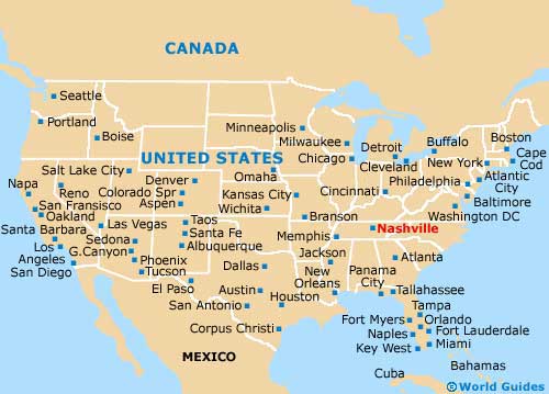
Map of the United States
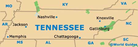
Map of Tennessee
Map of Nashville