Charleston Maps and Orientation
(Charleston, South Carolina - SC, USA)
Lying on South Carolina's eastern coastline and fronting the Atlantic Ocean, the seaport city of Charleston stands just across from Mount Pleasant and Sullivan's Island.
The skyline is one of towering church spires and bridges, the tallest of which is the Arthur Ravenel Junior Bridge, with its supporting towers measuring in at some 175 meters / 282 feet in height. The second-tallest structure in the city is the rather impressive St. Matthew's German Lutheran Church, whose steeple measures in at slightly more than 90 meters / 295 feet high.
The city has functioned as the county seat of Charleston County since the very beginning of the 20th century, although its boundaries spread as far as Berkeley County, while the Charleston-North Charleston-Summerville Metropolitan Area also comprises Dorchester County.
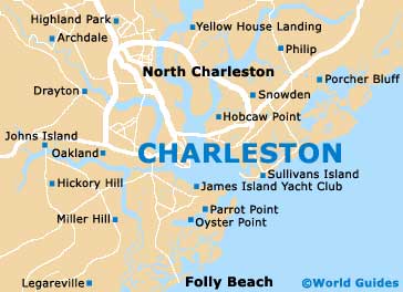
Maps and Orientation of the City
History buffs will enjoy strolling around the aptly named Historic District, which is to be found on the south side of Beaufain Street and Hasell Street. This part of the city boasts a plethora of pre-American Civil War mansions, as well as a good assortment of shops and eateries.
If you are planning to walk or drive around downtown Charleston, then maps can be obtained from the city's visitors center on Meeting Street, which is close to Wragg Square, the rather grand Joseph Manigault House (a National Historic Landmark since 1973) and the American Theater.
- Carlton Place - 6 miles / 10 km (12 minutes, north)
- Goose Creek - 18 miles / 29 km (30 minutes, north)
- Hanahan - 16 miles / 26 km (30 minutes, north)
- Isle of Palms - 15 miles / 24 km (25 minutes, east)
- James Island - 4 miles / 6 km (ten minutes, south)
- Ladson - 20 miles / 32 km (35 minutes, northwest)
- Magnolia Gardens - 13 miles / 21 km (25 minutes, northwest)
- Mount Pleasant - 7 miles / 11 km (12 minutes, east)
- North Charleston - 6 miles / 10 km (12 minutes, north)
- Summerville - 24 miles / 39 km (40 minutes, northwest)
- West Ashley - 9 miles / 14 km (15 minutes, west)
- Wild Dunes - 18 miles / 29 km (30 minutes, east)
Map of the United States

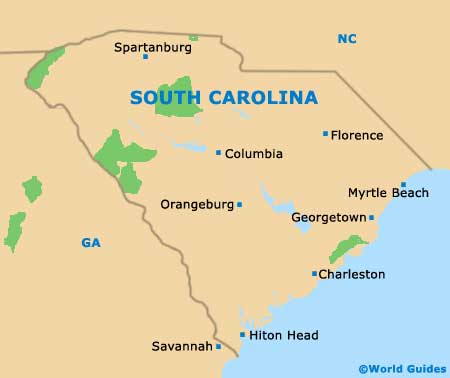
Map of South Carolina
Map of Charleston