Atlanta Maps and Orientation
(Atlanta, Georgia - GA, USA)
The biggest city in Georgia, Atlanta is the state capital and the administrative center of Fulton County, although roughly a tenth of the city actually resides within DeKalb County. Atlanta is very much a business center, with its economy ranking amongst America's most significant.
The metropolitan area of Atlanta boasts a population now topping five million and is fully encircled by the Interstate I-285, which is often simply referred to as the Perimeter. The Interstate I-20 (Ralph David Abernathy Freeway) runs through the city itself, heading in an east to west direction and dividing the city into north and south regions.
The Downtown Connector (Interstate I-75 / I-85) heads north to south and intersects the Interstate I-20. Downtown Atlanta lies to the west of the I-85, while to the east is Cabbagetown, Grant Park and the Old Fourth Ward.
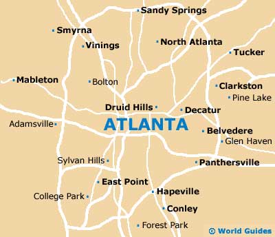
Maps and Orientation of the City
Although downtown Atlanta does contain a number of attractions to see and enjoy, most tourists will find the need to head into some of the surrounding suburbs to sightsee. These include Buckhead, Decatur, Little Five Points, Midtown, Sweet Auburn, Turner Field, Virginia Highlands and the West End.
If you require city maps, then be sure to check out the Atlanta Convention and Visitors Bureau on Peachtree Street, close to the Marriott Marquis and Hyatt Regency hotels, as well as the Mall at Peachtree Center.
- Alpharetta - 28 miles / 45 km (45 minutes, northeast)
- Chattanooga (TN) - 118 miles / 190 km (two hours and 40 minutes, northwest)
- Douglasville - 22 miles / 35 km (35 minutes, west)
- Dunwoody - 17 miles / 27 km (30 minutes, north)
- Forest Park - 11 miles / 18 km (20 minutes, south)
- Lawrenceville - 33 miles / 53 km (55 minutes, northeast)
- Mableton - 15 miles / 24 km (25 minutes, west)
- Marietta - 20 miles / 32 km (35 minutes, northwest)
- McDonough - 31 miles / 50 km (50 minutes, south)
- Newnan - 39 miles / 63 km (one hour, southwest)
- Peachtree City - 31 miles / 50 km (50 minutes, southwest)
- Riverdale - 13 miles / 21 km (25 minutes, south)
- Roswell - 22 miles / 35 km (35 minutes, north)
- Sandy Springs - 15 miles / 24 km (25 minutes, north)
- Smyrna - 15 miles / 24 km (25 minutes, northwest)
- Snellville - 25 miles / 40 km (40 minutes, east)
- Stockbridge - 21 miles / 34 km (35 minutes, south)
- Union City - 18 miles / 29 km (30 minutes, southwest)
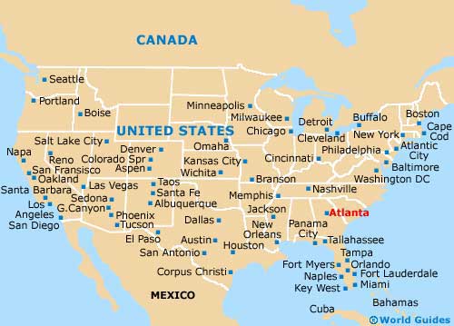
Map of the United States
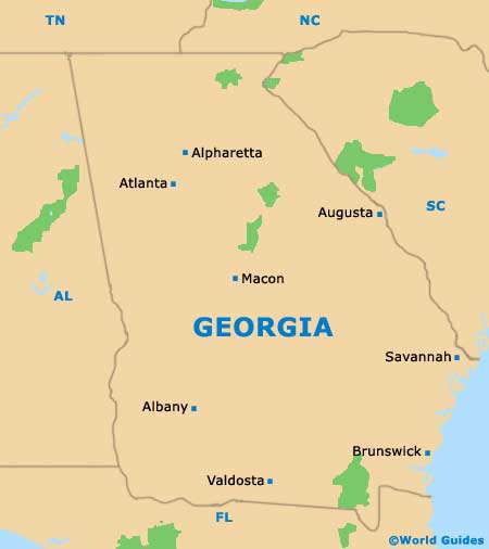
Map of Georgia
Map of Atlanta