Nice Maps and Orientation
(Nice, Provence-Alpes Côte d'Azur, France)
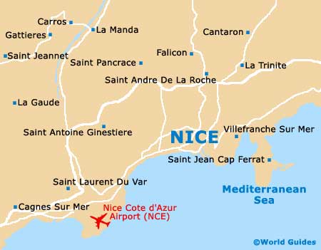
The beautiful city of Nice lies on the far, south-eastern Mediterranean coast of France, close to the border with northern Italy and within driving distance of Genoa. Nice is home to a population of around 350,000 people, while the sprawling metropolitan area has more than one million inhabitants.
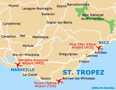
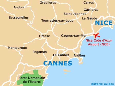
Nice is a major tourist hotpot on the famous French Riviera, better known in France as the Côte d'Azur, within the County of Nice. The city is particularly close to a number of France's most popular resorts and tourist destinations, such as
Marseille, Cannes and Saint Tropez.
Maps and Orientation of the City
Edged with a magnificent, arched beachfront, Nice's Promenade des Anglais is one of the city's most famous landmarks and offers excellent sea views. Other notable thoroughfares include the Avenue Jean Médecin, which is close to the Gare Nice Ville (train station) and heads in a southerly direction.
Central Nice is based around the Place Masséna, while the neighbouring streets of both Rue Masséna and Rue de France are a great place for shopping.
- Antibes - 29 km / 18 miles (30 minutes, south-west)
- Cagnes-Sur-Mer - 16 km / 10 miles (18 minutes, west)
- Cannes - 35 km / 22 miles (30 minutes, south-west)
- Carros - 24 km / 15 miles (25 minutes, north)
- Contes - 16 km / 10 miles (18 minutes, north)
- Grasse - 45 km / 28 miles (40 minutes, west)
- Menton - 29 km / 18 miles (30 minutes, north-east)
- Monaco - 19 km / 12 miles (20 minutes, east)
- Saint Tropez - 112 km / 70 miles (one hour and 20 minutes, south-west)
- Saint-Laurent-Du-Var - 11 km / 7 miles (15 minutes, south-west)
- Toulon - 149 km / 93 miles (one hour and 30 minutes, south-west)
- Vallauris - 29 km / 18 miles (30 minutes, south-west)
- Vence - 24 km / 15 miles (20 minutes, west)
Map of France

Map of Nice