Turku Maps and Orientation
(Turku, Finland Proper, Finland)
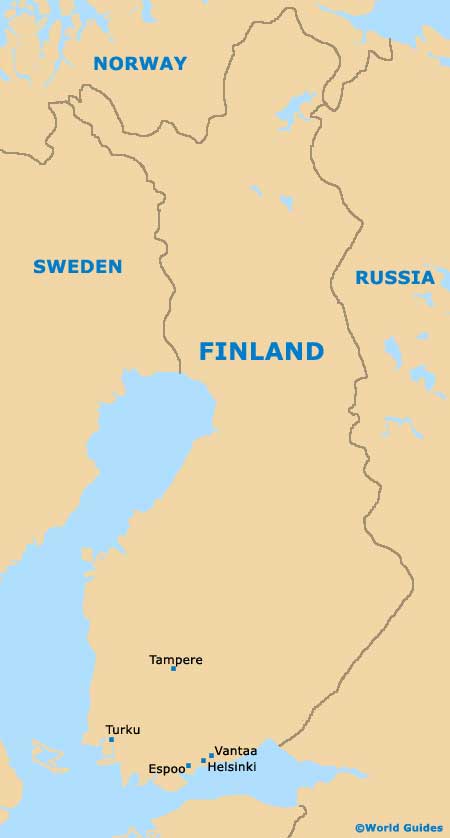
Finland's fifth-biggest city, Turku is located on the south-western side of the country and has a population of approximately 180,000 people. Turku's harbour is amongst the most important seaports within the whole of
Finland and each year is used by almost four million passengers.
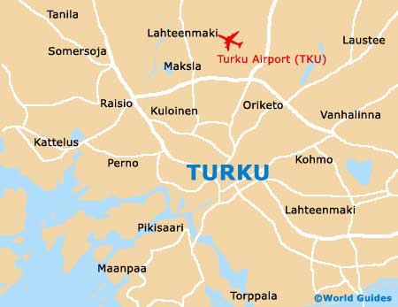
Sited around the River Aurajoki (Aura), which divides the city into two significant areas, central Turku stands approximately 3 km / 2 miles directly north of the actual harbour, with regular buses connecting each of the arriving ferries. Most places close to central Turku are simple to reach on foot, with maps of the city being available at the Akateeminen Kirjakuppa bookshop in the Hansa Shopping Arcade, on the Yliopistonkatu.
Maps and Orientation of the City
The very heart of modern-day Turku is based around the market square known as the Kauppatori, while the river banks have generally become a place for socialising and relaxing, both by day and night. The Turku City Tourist Office can be found on the Aurakatu and is another good place to obtain maps, whilst also providing free access to the Internet.
- Espoo - 150 km / 93 miles (two hours ten minutes, south-west)
- Halikko - 52 km / 32 miles (55 minutes, east)
- Helsinki - 169 km / 105 miles (two hours and 25 minutes, south-west)
- Kaarina - 9 km / 6 miles (15 minutes, south)
- Lieto - 13 km / 8 miles (20 minutes, east)
- Loimaa - 66 km / 41 miles (one hour and five minutes, north-east)
- Nokia - 151 km / 94 miles (two hours ten minutes, north-east)
- Parainen - 23 km / 14 miles (30 minutes, south)
- Rauma - 92 km / 57 miles (one hour and 30 minutes, north-west)
- Salo - 58 km / 36 miles (one hour, east)
- Somero - 86 km / 53 miles (one hour and 20 minutes, east)
- Tampere - 162 km / 101 miles (two hours and 15 minutes, north-east)
- Vammala - 116 km / 72 miles (one hour and 50 minutes, north-east)
- Vantaa- 172 km / 107 miles (two hours 25 minutes, south-west)
Map of Finland
Map of Turku