Leicester Maps and Orientation
(Leicester, Leicestershire, England, UK)
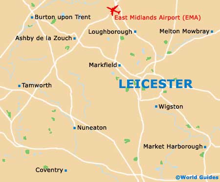
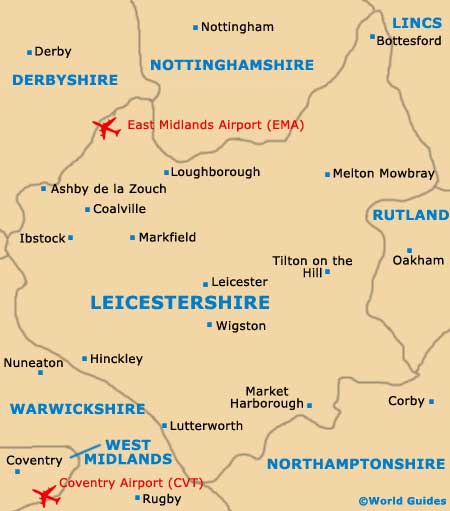
Located in central
England and in the East Midlands area, the city of Leicester is the county town of Leicestershire and has grown up around the River Soar. Leicester stands directly to the south of Loughborough,
Nottingham and
Derby, and north of
Coventry.
The city now has a population exceeding 300,000 people, while the Leicester Urban Area is home to approximately 450,000 people. This spreading region encompasses the villages of Birstall, Blaby, Cosby, Groby, Kirby Muxloe, Queniborough, Ratby and Whetstone, as well as the towns of both Oadby and Wigston Magna.
Maps and Orientation of the City
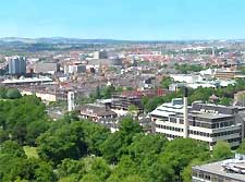
When you first arrive in Leicester, you may well find it a little difficult to find your way around, since there are only a handful of memorable landmarks and a maze of winding one-way only streets. However, the city centre surrounding the market is quite simple to navigate if you are on foot, being well pedestrianised and featuring a prominent clock tower.
Leicester does not actually have a ring road, although the A594 does virtually encircle the entire city and connect many places of interest. Notable districts include the north-easterly Golden Mile (Belgrave Road) and Castle Park, which is to be found on the western side of the city centre, next to the De Montfort University. For city maps, the Leicester tourist information centre (TIC) is the place to come and is situated on Every Street, on Town Hall Square.
- Ashby de la Zouch - 31 km / 19 miles (40 minutes, north-west)
- Birmingham - 69 km / 43 miles (one hour and five minutes, south-west)
- Burton Upon Trent - 46 km / 29 miles (50 minutes, north-west)
- Cheltenham - 149 km / 93 miles (two hours, south-west)
- Coalville - 22 km / 14 miles (25 minutes, north-west)
- Corby - 40 km / 25 miles (45 minutes, south-east)
- Coventry - 40 km / 25 miles (45 minutes, south-west)
- Derby - 59 km / 37 miles (55 minutes, north-west)
- Gloucester - 154 km / 96 miles (two hours, south-west)
- Grantham - 45 km / 28 miles (50 minutes, north-east)
- Loughborough - 21 km / 13 miles (25 minutes, north)
- Lutterworth - 29 km / 18 miles (35 minutes, south)
- Market Harborough - 26 km / 16 miles (30 minutes, south-east)
- Markfield - 14 km / 9 miles (22 minutes, north-west)
- Melton Mowbray - 27 km / 17 miles (30 minutes, north-east)
- Milton Keynes - 85 km / 53 miles (one hour and 15 minutes, south-east)
- Nottingham - 46 km / 29 miles (50 minutes, north)
- Nuneaton - 32 km / 20 miles (40 minutes, south-west)
- Oxford - 134 km / 84 miles (one hour and 50 minutes, south)
- Peterborough - 66 km / 41 miles (one hour and five minutes, east)
- Rugby - 42 km / 26 miles (45 minutes, south)
- Sheffield - 120 km / 75 miles (one hour and 35 minutes, north)
- Sutton Coldfield - 67 km / 42 miles (one hour, west)
- Swadlincote - 38 km / 24 miles (45 minutes, north-west)
- Tamworth - 54 km / 34 miles (55 minutes, west)
- Wigston - 10 km / 6 miles (15 minutes, south)
Map of the United Kingdom

Map of Leicestershire
Map of Leicester