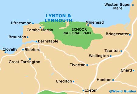
Lynton and Lynmouth Maps and Orientation
(Lynton and Lynmouth, North Devon, England, UK)
The twin towns of Lynton and Lynmouth lie alongside each other, in the county of Devon and on the northerly shore of Exmoor. Lynmouth enjoys a gorge setting and straddles the meeting point of the East Lyn River and the West Lyn River, while Lynton stands some 210 metres / 690 feet above and is connected by a famous, historic cliff railway.
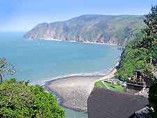
Lynton and Lynmouth provides the perfect base to properly explore North Devon and Exmoor, and offers a variety of popular walking trails, which often take in sumptuous views of the coastline, surrounding undulating moorland scenery and famous Exmoor ponies. The beachfront is full of life during the summer months, and tends to be where most people head first.
Maps and Orientation of the Towns
Maps of the area are available at the Lynton and Lynmouth Tourist Information Centre, which stands close to the beachfront and on Lee Road, in the Town Hall and next to the cinema. Here you will also find various guide books, walking equipment and dog leads. The following destinations are within reach of both towns:
- Alcombe - 29 km / 18 miles (30 minutes, south-east)
- Barbrook - 5 km / 3 miles (five minutes, south)
- Barnstaple - 30 km / 19 miles (30 minutes, south-west)
- Bath - 136 km / 85 miles (two hours and 30 minutes, north-east)
- Bideford - 46 km / 29 miles (50 minutes, south-west)
- Bilbrook - 37 km / 23 miles (35 minutes, east)
- Braunton - 37 km / 23 miles (35 minutes, south-west)
- Bridgwater - 69 km / 43 miles (one hour and ten minutes, south-east)
- Bristol - 126 km / 79 miles (two hours and ten minutes, north-east)
- Carhampton - 34 km / 21 miles (35 minutes, )
- Clovelly - 64 km / 40 miles (one hour and ten minutes, south-west)
- Combe Martin - 21 km / 13 miles (20 minutes, west)
- Countisbury - 5 km / 3 miles (five minutes, east)
- Dunster - 32 km / 20 miles (35 minutes, east)
- Exeter - 88 km / 55 miles (one hour and 30 minutes, south)
- Ilfracombe - 29 km / 18 miles (30 minutes, west)
- Malmsmead - 11 km / 7 miles (12 minutes, east)
- Minehead - 29 km / 18 miles (30 minutes, east)
- Plymouth - 131 km / 82 miles (two hours and 25 minutes, south)
- Porlock - 19 km / 12 miles (20 minutes, east)
- Taunton - 66 km / 41 miles (one hour and ten minutes, south-east)
- Tiverton - 64 km / 40 miles (one hour, south)
- Yeovil - 108 km / 67 miles (one hour and 55 minutes, south)
- Washford - 38 km / 24 miles (40 minutes, east)
- Watchet - 42 km / 26 miles (45 minutes, east)
- Wellington - 70 km / 44 miles (one hour and 15 minutes, south-east)
- Weston Super Mare - 99 km / 62 miles (one hour and 45 minutes, north-east)
- Woolacombe - 34 km / 21 miles (30 minutes, west)
- Williton - 42 km / 26 miles (45 minutes, east)
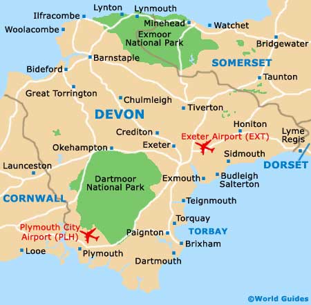
Map of the United Kingdom

Map of Devon
Map of Lynton and Lynmouth