Bruges Maps and Orientation
(Bruges, West Flanders, Belgium)
Situated within Belgium's Western Flanders province, around 125,000 Belgians currently call Bruges their home. Bruges is actually the provincial capital and lies on the north-western side of Belgium, being extremely close to the port of Zeebrugge, and also near to the
Netherlands.
Bruges is an important port city in Belgium and its large harbour has brought it considerable wealth over the years. Many sights are just a leisurely stroll from the harbour and close to the compact city centre.
Maps and Orientation of the City
Much of Bruges is surrounded by a long, oval-shaped moat, which has been built around the medieval fortifications. Out of the city's nine original gateways, four are still standing and date back as far as the early part of the 14th century.
Within central Bruges, two public squares are particularly prominent, the Burg and the Markt. The train station is approximately 1.5 km / 1 mile directly south of the city's Markt and is linked by regular buses. Should you wish to purchase a map of Bruges, check out the tourist office on the Burg, within the Bruges Vrije (Palace of the Liberty). Bruges is also home to a number of bookshops, with the best to be found on the Dijver and the Jakobsstraat.
- Antwerp - 107 km / 66 miles (one hour and 15 minutes, east)
- Breda Tilburg - 179 km / 111 miles (two hours and 20 minutes, east)
- Brussels - 102 km / 63 miles (one hour and 15 minutes, south-east)
- Charleroi - 154 km / 96 miles (two hours, south-east)
- Damme - 5 km / 3 miles (ten minutes, north-east)
- Dunkerque - 75 km / 47 miles (one hour and five minutes, west)
- Eindhoven (Netherlands) - 194 km / 121 miles (two hours and 15 minutes, east)
- Ghent - 56 km / 35 miles (one hour, south-east)
- Liege - 198 km / 123 miles (two hours and 35 minutes, south-east)
- Maastricht (Netherlands) - 225 km / 140 miles (two hours and 55 minutes, south-east)
- Ostend - 31 km / 19 miles (35 minutes, west)
- Namur - 171 km / 106 miles (two hours and 15 minutes, south-east)
- Roeselare - 41 km / 25 miles (35 minutes, south)
- Roubaix - 76 km / 47 miles (one hour, south)
- Valenciennes - 125 km / 78 miles (one hour and 25 minutes, south)
- Zeebrugge - 17 km / 11 miles (25 minutes, north)
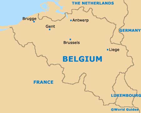
Map of Belgium
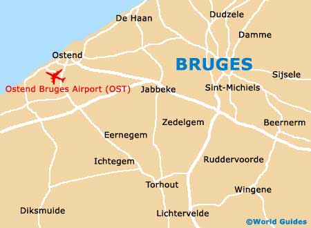
Map of Bruges