Sulawesi Maps and Orientation
(Sulawesi, Sunda Islands, Indonesia)
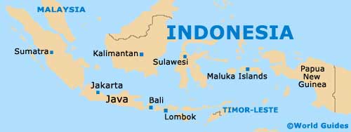
One of Indonesia's major Sunda Islands, Sulawesi is sandwiched between both Borneo and also the
Maluku Islands (Moluccas). Many smaller islands are dotted around the coastline, such as those of Banggai, Buton, Manui, Peleng and Taliabu.
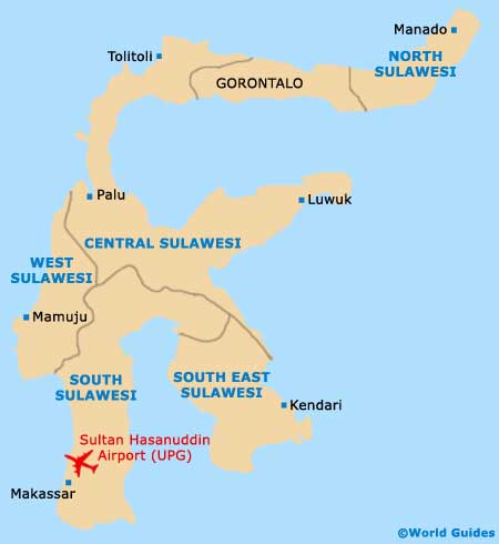
If you look at Sulawesi on a map, you will immediately be struck by its very unusual shape, since it really is little more than a collection of peninsulas. The main regions of Sulawesi are named North, Central, South and South-East.
Maps and Orientation of the Island
The main cities and resorts of Sulawesi include Gorontalo, Makassar, Manado and Palu. Makassar is especially popular and is the biggest city of Sulawesi, being the prominent southerly capital.
- Bacan Islands - east
- Bali - south-west
- Baluran National Park (East Java) - south-west
- Bandung (West Java) - south-west
- Banten (West Java) - south-west
- Borobudur (Central Java) - south-west
- Flores - south
- Jakarta (West Java) - south-west
- Kalimantan - west
- Komodo - south
- Kuala Lumpur (Malaysia) - north-west
- Lombok Island - south-west
- Malang (East Java) - south-west
- Maluku Islands - east
- Rinca - south
- Semarang (Central Java) - south-west
- Singapore - north-west
- Solo / Surakarta (Central Java) - south-west
- Sulu Islands - east
- Sumatra Island - west
- Sumba - south
- Sumbawa - south
- Surabaya (East Java) - south-west
- Timor - south
- Yogyakarta (Central Java) - south-west
Map of Indonesia
Map of Sulawesi