Tianjin Maps and Orientation
(Tianjin, China)
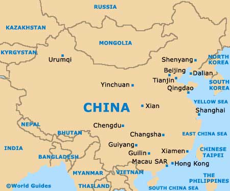
The city of Tianjin lies on the north-eastern side of China and is one of the country's four important municipalities, ranking amongst the country's largest and most densely populated cities, with a population exceeding ten million people. Tianjin stands directly south-east of
Beijing and comprises many large expanses of rural areas and farmland.
Within the city itself, Hai He River splits the urban city into two main regions, connecting the Grand Canal of China, with the main train station located on the river's northern side. Other rivers winding their way around the city of Tianjin include the Daqing, Yongding and Ziya rivers.
Maps and Orientation of the City
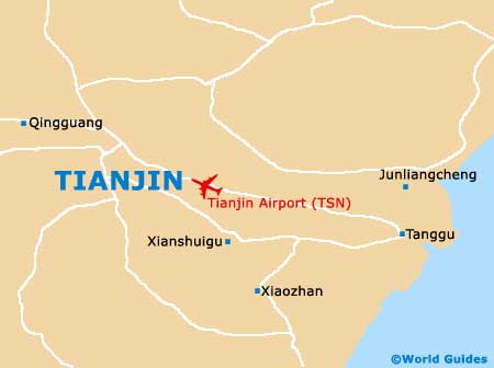
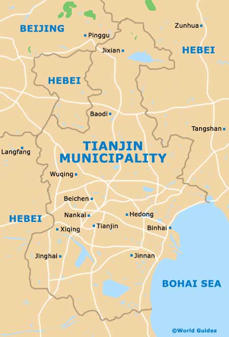
On the southern side of the train station, the Jiefang Bridge is a useful point of reference. A number of prominent ports sit atop the east of Tianjin, standing next to the Bohai Bay and Dagang Harbour, while to the north, the China's Hebei Province surrounds much of the city and features the eastern stretch of the Great Wall of China.
Notable landmarks around central Tianjin include the Shi Family Courtyards to the west, the Tanggu resort to the east, and Zhangguizhuang Airport to the north-east. Be sure to bring a fold-up map during your visit to Tianjin, which can prove invaluable and help you find your way around the city. English-language maps are usually available at the airport, and also in the city itself, at major hotels, at map sellers at the train station, at the Tianjin Tourism Bureau on Youyi Lu, and also at the Xinhua Bookstore.
Close to Tianjin are a series of cities, towns and villages, many of which warrant exploration and are show below, together with relevant orientation.
- Baoding - south-west
- Beijing - north-east
- Botou - south
- Cangzhou - south
- Ninghe - north-east
- Langfang - north-west
- Tanggu - east
- Tangguantun - south
- Tangshann - north-east
- Zhuozhou - north-west
Map of China
Map of Tianjin Municipality
Map of Tianjin