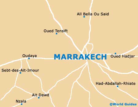
Marrakech Maps and Orientation
(Marrakech, Morocco)
Located within North Africa and on the south-western side of
Morocco, Marrakech is a large and important city, called home by in excess of one million residents. The city serves as the capital of the Marrakech-Tensift-Al Haouz and is particularly close to the very scenic Atlas Mountains.
Marrakech can be roughly divided into two main regions - the historical Medina and the Ville Nouvelle (New City), both of which are similar in overall size. The Ville Nouvelle encompasses a number of rather appealing districts, such as the Hivernage and the Guéliz.
Maps and Orientation of the City
From the Place du 16 Novembre in the heart of the Ville Nouvelle, the Djemaa El Fna is within easy walking distance and forms the very centre of the old city of Medina. The Djemass el-Fna can be reached by walking along the Avenue Mohammed V, passing both the Place de la Liberté and the Place de Foucauld along the way.
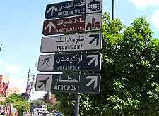
Directly north of the Djemma is the Moussine Mouque and the famous souqs (markets) of Marrakech, while to the south are the main palaces, and to the south-west the Koutoubia Mosque. The Djemass el-Fna is surrounded by a number of budget hotels. In the Ville Nouvelle area of Marrakech, the Hivernage neighbourhood contains plenty of mid-range and luxury accommodation options. For city maps, check out the Office National Marocain du Tourism (ONMT) on the Place Abdel Moumen ben Ali in the Guéliz area of the Ville Nouvelle.
- Agadir - south-west
- Ait Benhaddou - south
- Asni - south
- Azilal - east
- Amizmiz - south
- Casablanca - north
- Dar-el-Beida - north
- El-Kalaa des Srarhna - north-east
- Erfoud - east
- Essaouira - west
- Jadida - north
- Jebel Toubkal - south
- Khouribga - north-east
- Meknes - north
- Mohammedia - north
- Ouarzazate - south
- Oukaimeden - south
- Ourika Valley - south
- Rabat - north-east
- Safi - north-west
- Settat - north
- Setti Fatma - south
- Tafraoute - south-west
- Taroudant - south-west
- Telouet - south
- Todra Gorge - east
Continent Map of Africa

Map of Morroco

Map of Marrakech