Lincoln Maps and Orientation
(Lincoln, Nebraska - NE, USA)
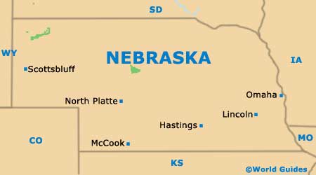
The state of Nebraska enjoys a setting in the very heart of North America, with Lincoln serving as its sizeable capital city. However, with a population of roughly 265,000 people, the state capital of Lincoln is not actually the biggest city in Nebraska, since Omaha's population is now more than 400,000.
The Lincoln metropolitan area encompasses both Seward County and Lancaster County, which together make up a population exceeding 300,000.
As well as being the state capital, Lincoln also functions as the county seat for Lancaster County, being where you will find the University of Nebraska. Interestingly, this city ranks amongst only a handful in Nebraska not to be situated alongside either the Missouri River or the Platte River.
Maps and Orientation of the City
With the gradual expansion of the city over the years, many surrounding towns, villages and suburbs have been swallowed up, creating a number of local neighborhoods. These are usually clearly annotated on most maps of Lincoln and include the likes of Arnold Heights, Belmont, Bethany, Capitol Beach, Eastridge, Everett, Havelock, Hartley, Irvingdale, Piedmont and Williamsburg.
Downtown Lincoln is the city's principal business district, which its assortment of offices, eateries and shops. For a real taste of history, take a stroll around Haymarket, Huskerville, Near South, Sheridan and University Place, and don't miss out the Historic Bungalow District, where the Children's Zoo awaits families.
- Arnold Heights - northwest
- Belmont - northwest
- Bethany - northeast
- Beatrice - south
- Capitol Beach - west
- Eastridge - east
- Everett - southwest
- Fremont - north
- Grand Island - west
- Hastings - west
- Kearney - west
- Millard - northeast
- Nebraska City - east
- Omaha - northeast
- Pawnee Lake State Recreation Area - west
Map of USA
Map of Nebraska
Map of Lincoln
