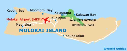
Molokai Maps and Orientation
(Molokai, Hawaii - HI, USA)
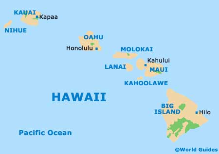
The Hawaiian island of Molokai is relatively small in its overall size, stretching some 61 km / 38 miles in width, by just 16 km / 10 miles in depth / length. These dimensions mean that Molokai is actually the fifth-biggest of all the islands within the Hawaiian archipelago, after the
Big Island, Kauai,
Maui and Oahu.
Molokai is situated directly to the east of Oahu, being separated by the Kaiwi Channel, with
Honolulu being visible on a clear day. To the south you will find the Kalohi Channel and the Hawaiian islands of Lanai and Maui, both of which can be easily seen along more parts of the southern coastline.
Maps and Orientation of the Island
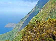
The island comprises two imposing volcanoes, which form the regions of East Molokai and also West Molokai, the latter of which is smaller and therefore less significant. Stretching between Halawa and Hoolehua, the North Shore actually comprises some of the tallest sea cliffs in existence, anywhere on the planet.
The biggest town on Molokai is Kaunakakai, where shops selling maps of the island are easy to find. Other towns and villages of note include Kalaupapa, Kualapuu and also Maunaloa. The island's southerly shore is home to a series of traditional Hawaiian fish ponds, which are worth looking out for.
Map of the United States

Islands of Hawaii Map
Map of Molokai