Tallahassee Maps and Orientation
(Tallahassee, Florida - FL, USA)
The far northern side of Florida is where you will find the city of Tallahassee, being close to the border with
Georgia (north) and the Apalachicola National Forest (southwest).
Functioning as the seat for Leon County, this is actually the county's sole incorporated municipality and more importantly, the capital of Florida, even though Jacksonville boasts a population of over four times that of Tallahassee.
Tallahassee is known for its numerous colleges and two principal universities. Located on the southern side of the city is the campus of the Florida Agricultural and Mechanical University, home of the Bragg Memorial Stadium. Close by and to the north, the Florida State University campus is based around West College Avenue.
Maps and Orientation of the City
If you are planning to find your way around the city via maps, then you may find a trip to the Tallahassee Visitor Center a beneficial one.
Located on East Jefferson Street, this tourism bureau is a good place to pick up a map or two, being easy to find since it stands next to the Tallahassee City Hall and the Florida State Capitol building. Parking bays for up to 30 minutes are conveniently located right outside, on the street.
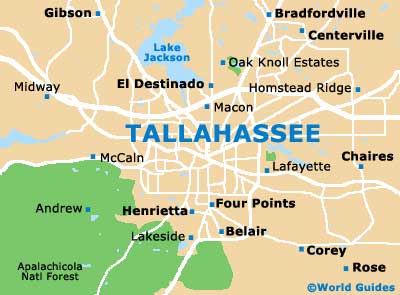
- Albany - 87 miles / 140 km (two hours and five minutes, north)
- Belair - 4 miles / 6 km (12 minutes, south)
- Chaires - 13 miles / 21 km (25 minutes, east)
- Corey - 10 miles / 16 km (20 minutes, southeast)
- El Destinado - 5 miles / 8 km (12 minutes, north)
- Henrietta - 4 miles / 6 km (12 minutes, south)
- Lafayette - 83 miles / 134 km (two hours, southeast)
- Lake Miccosukee - 22 miles / 35 km (40 minutes, northeast)
- Lake Talquin State Forest - 35 miles / 56 km (50 minutes, west)
- Oak Ridge - 5 miles / 8 km (12 minutes, south)
- Panama City - 100 miles / 161 km (two hours and 30 minutes, southwest)
- Quincy - 23 miles / 37 km (40 minutes, northwest)
- Rose - 13 miles / 21 km (25 minutes, southeast)
- Seminole Manor - 7 miles / 11 km (15 minutes, west)
- Wakulla Beach - 25 miles / 40 km (45 minutes, south)
- Woodville - 9 miles / 14 km (15 minutes, south)
Map of the United States
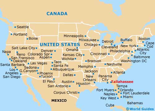
Map of Florida

Map of Tallahassee