Colorado Springs Maps and Orientation
(Colorado Springs, Colorado - CO, USA)
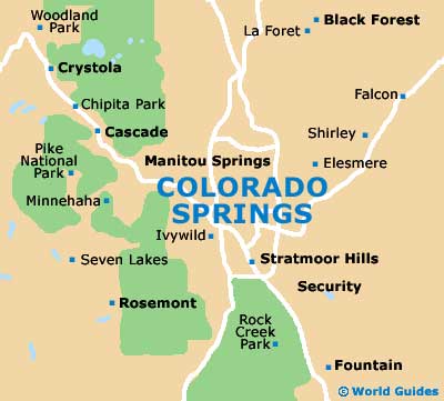
Located close to the center of Colorado state and directly south of
Denver, the city of Colorado Springs serves as the county seat of El Paso County. The city stands next to the Fountain Creek stream and close to the famous mountain, Pikes Peak, which resides on the eastern side of the Southern Rockies.
Interstate I-25 (Ronald Reagan Highway / Monument Valley Highway) bounds the western side of Colorado Springs and divides the metropolitan area into east and west regions. Of note, the western side of the I-25 is where you will find the Garden of the Gods and also Manitou Springs, while to the east is the city's municipal airport, the Cimarron Hills and also the Central Business District (CBD).
Head to the south of central Colorado Springs and you will soon reach both Fort Carson and the Cheyenne Mountain State Park. To the far southwest and reached along the Vietnam Veterans Memorial Highway SH-115 is Rock Creek and also the Beaver Creek State Wildlife Area.
Maps and Orientation of the City
If you are planning to find your way around the city, then maps can be obtained at the Colorado Springs Visitor Information Center on South Cascade Avenue, close to the Warehouse Restaurant and Gallery.
The visitors center is just a short walk east of the America the Beautiful Park, via West Cimarron Street, and is roughly two blocks to the south of both the Colorado Springs Pioneers Museum and the Pikes Peak Center.
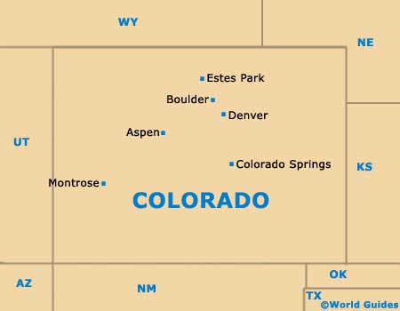
- Aspen - 242 miles / 389 km (six hours and 30 minutes, northwest)
- Black Forest - 19 miles / 31 km (30 minutes, northeast)
- Boulder - 97 miles / 156 km (two hours and 15 minutes, north)
- Canon City - 46 miles / 74 km (one hour and 15 minutes, southwest)
- Castle Rock - 41 miles / 66 km (one hour and 5 minutes, north)
- Cimarron Hills - 8 miles / 13 km (15 minutes, east)
- Cripple Creek - 45 miles / 72 km (one hour 10 minutes, southwest)
- Denver - 71 miles / 114 km (one hour and 50 minutes, north)
- Eastonville - 30 miles / 48 km (50 minutes, northeast)
- Estes Park - 140 miles / 225 km (three hours, northwest)
- Fort Carson - 8 miles / 13 km (15 minutes, south)
- Gleneagle - 17 miles / 27 km (30 minutes, north)
- Larkspur - 32 miles / 51 km (50 minutes, north)
- Palmer Lake - 24 miles / 39 km (38 minutes, north)
- Penrose - 34 miles / 55 km (55 minutes, southwest)
- Pueblo - 45 miles / 72 km (one hour 10 minutes, south)
- Woodland Park - 19 miles / 31 km (30 minutes, northwest)
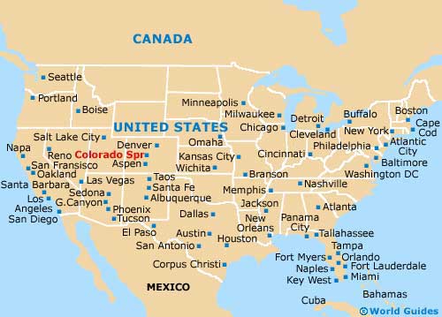
Map of the United States
Map of Colorado
Map of Colorado Springs