Lake Louise Maps and Orientation
(Lake Louise, Alberta - AB, Canada)
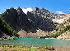
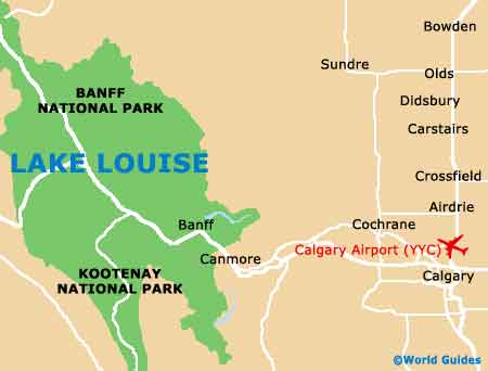
An immensely beautiful lake and popular resort within the very heart of the
Banff National Park, Lake Louise lies close to the Trans Canada Highway 93 and off the Lake Louise Drive. The area is quite different to its nearby sister resort of
Banff, which lies just 45 minutes away and to the south-east, comprising two very distinct resort areas.
The first of these districts is made up of a collection of hotels and small shops, and this small hamlet is known simply as Lake Louise Village. The second resort is of course the actual lake, which is situated a mere 4 km / 2.5 miles from the village itself and enjoys a more elevated setting.
Maps and Orientation of the Village
It is actually quite possible to walk between the lake and the village, along wither the Louise Creek Trail, or the Tramline Trail. However, the best walking trails lie around Lake Louise and so you would be sensible to simply catch a taxi between these areas, and save you time for some even better views.
Of note, there is a third resort area nearby - the Moraine Lake, which is to be found around 13 km / 8 miles from the village and to the south. These Lake Louise resorts are at their busiest in the summer season, although in the winter, the powdery snow does attract crowds of skiers to the Front Side (South Face ) area. Maps of the region and the various hiking trails are available at the very impressive Lake Louise Information Centre, and at the Woodruff and Blum bookstore within the Samson Mall.
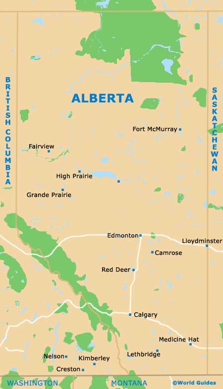
- Airdrie - 210 km / 130 miles (two hours and 20 minutes, east)
- Banff - 57 km / 35 miles (45 minutes, south-east)
- Calgary - 182 km / 113 miles (two hours and five minutes, east)
- Camrose - 467 km / 290 miles (five hours, north-east)
- Canmore - 80 km / 50 miles (one hour and ten minutes, south-east)
- Cranbrook - 273 km / 170 miles (three hours and 30 minutes, south)
- Edmonton - 476 km / 296 miles (five hours, north-east)
- Jasper - 232 km / 144 miles (three hours, north-west)
- Jasper National Park - 207 km / 129 miles (two hours and 50 minutes, north-west)
- Kamloops - 439 km / 273 miles (five hours and 25 minutes, west)
- Kelowna - 427 km / 265 miles (five hours and 20 minutes, south-west)
- Lacombe - 350 km / 217 miles (three hours and 40 minutes, north-east)
- Lethbridge - 399 km / 248 miles (four hours and 20 minutes, south-east)
- Okotoks - 224 km / 139 miles (two hours and 30 minutes, south-east)
- Red Deer - 322 km / 200 miles (three hours and 25 minutes, north-east)
- Revelstoke - 228 km / 142 miles (two hours and 50 minutes, south-west)
- Sylvan Lake - 345 km / 214 miles (three hours and 40 minutes, north-east)
Map of Canada

Map of Alberta
Map of Lake Louise