Trinidad Maps and Orientation
(Trinidad, Republic of Trinidad and Tobago)
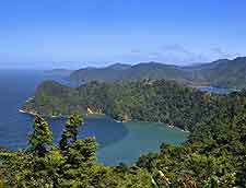
One of just many islands making up the country of Trinidad and Tobago, this island resides within the southern Caribbean, where it is just over 10 km / 6 miles from the north-easterly shoreline of Venezuela.
This is actually the sixth-biggest of all the islands within the actual West Indies (Antilles) and is considerably larger than the neighbouring island of Tobago, which lies to the north-east and is around 31 km / 19 miles away. With a population of some 1.3 million residents, Trinidad is approximately 80 km / 50 miles in length and around 60 km / 37 miles in width.
Maps and Orientation of the Island
The Port of Spain is the island's capital city and stands on the north-westerly coast, next to the Gulf of Paria. Many historical attractions reside in this part of Trinidad, especially within the downtown Port of Spain, which is generally known as simply the 'Town' and based around the rather green and pleasant Woodford Square. The City Hall flanks the northern edge of Woodford Square, while the magnificent Holy Trinity Cathedral bounds the southern side.
Although Port of Spain is the capital, it is actually only the third-largest city on the island, after both San Fernando and Chaguanas, which are located directly to the south. Other important cities on Trinidad include Arima - to the east of Port of Spain, Pointe-a-Pierre and Point Lisas to the south, and Port Fortin to the far south-west. If you are planning to rent your own set of wheels, detailed road maps of Trinidad will be essential and ensure that you can navigate your way around the island with relative ease.
Trinidad is situated within reach of the following locations:
- Barbados - north
- Carrera - north-west
- Carupano (Venezuela) - west
- Chacachacare - north-west
- Cristobal Colon (Venezuela) - west
- Diego Island - north-west
- Five Islands - north-west
- Gaspar Grande - north-west
- Huevos - north-west
- Isla Margarita (Venezuela) - north-west
- Martinique - north
- Maturin (Venezuela) - west
- Monos - north-west
- Puerto de Hierro (Venezuela) - west
- Puerto Escondido (Venezuela) - north-west
- San Juan (Venezuela) - north-west
- St. Lucia - north
- St. Vincent and the Grenadines - north
- Tobago - north-east
Map ofthe Republic of Trinidad and Tobago
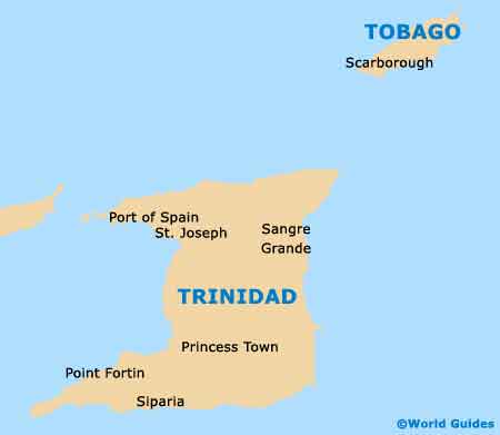
Map of Trinidad

