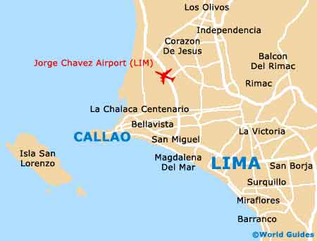
Lima Maps and Orientation
(Lima, Peru)
As the capital of
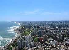
Peru, Lima is a large and impressive city, with a population now exceeding eight million people. Lima has grown to become a much-visited Peruvian city and lies within the Chillon Valley and the Rimac Valley, and is the region known as the Peruvian Coastal Plain (Sechura Desert), where it enjoys an especially scenic situation, alongside the Rimac River.
Located on the south-westerly coast of Peru and a mere 15 km / 9 miles from the South Pacific Ocean, the city of Lima was founded as long ago as the mid-1530s and is served by its seaport suburb of Callao. Today, the city is nothing short of a fast-moving metropolis and yet manages to successfully retain much of its colonial charm, particularly around the central Plaza de Armas square (known to many as the Plaza Mayor), and also the Parque de la Cultura and the Plaza San Martin.
Maps and Orientation of the City
Make no mistake - Lima is a large and busy city, with no less than 50 individual districts, meaning that maps are essential for those planning to explore the principal places of interest. Maps are available at various bookstores located along the Alfredo Benavides, the Avenida José Larco, the Malecon de la Reserva, and the Santiago de Surco, all of which are good places to look. The main districts of Lima are the Barranco, the Jesus Maria, the Miraflores, the San Isidro and also the Santa Beatriz.
- Ayacucho - south-east
- Cajamarquilla - north
- Callao - west
- Cerro de Pasco - north-east
- Chaclacayo - north-east
- Chimbote - north
- Chosica - north-east
- Huacho - north
- Huancavelica - south-east
- Huancayo - east
- Huanta - south-east
- Huaraz - north
- Ica - south
- Pachacamac - south-east
- Parque Nacional Huascarán - north
- Pisco - south
- Puruchuco - south-east
- Tarma - north-east
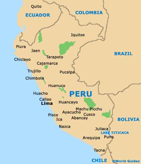
Map of Peru
Map of Lima