Buzios Maps and Orientation
(Buzios, Rio de Janeiro, Brazil)
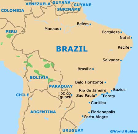
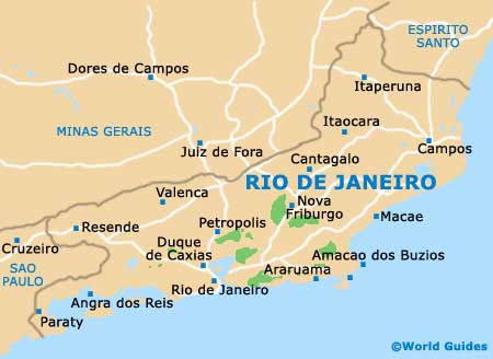
Situated within the state of Rio de Janeiro and on the south-eastern side of
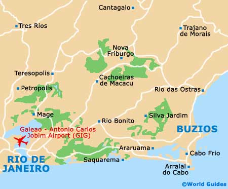
Brazil, the resort of Buzios enjoys a scenic peninsula setting, with more than 20 beaches in the vicinity. Buzios is not actually one town, but is instead made up of three settlements on the peninsula (Armacao de Buzios, Manguinhos and Ossos), as well as the mainland community of Rasa.
Ossos occupies the peninsula's northerly tip and boasts a particularly scenic setting, coming with its very own harbourfront and yacht club, together with a small selection of accommodation and eateries. Manguinhos occupies the narrow strip of land connecting the mainland and is known for being rather commercial, while Armacao de Buzios lies between both Ossos and Manguinhos, and is where the majority of tourist appeal resides.
Maps and Orientation of the Town
Armacao is where you will find the main drag, the historic Rua das Pedras (Avenida José Bento Ribeiro Dantas), which connects Ossos and is central to the region's nightlife. Rasa is located on the north-western side of the coastline and regularly attracts wealthy Brazilians, who often choose to holiday here.
Area maps are always available at the Secretaria de Turismo tourist outlets on the Rua das Pedras and the Praca Santos Dumont.
- Araruama - 58 km / 36 miles (one hour and 15 minutes, south-west)
- Arraial do Cabo - 38 km / 24 miles (50 minutes, south)
- Cabo Frio - 25 km / 16 miles (35 minutes, south-west)
- Casimiro de Abreu - 88 km / 55 miles (one hour and 50 minutes, north-west)
- Iguaba Grande - 43 km / 27 miles (55 minutes, south-west)
- Itaborai - 122 km / 76 miles (two hours and 20 minutes, west)
- Lagoa Juturnaiba - 62 km / 39 miles (one hour and 45 minutes, west)
- Macaé - 84 km / 52 miles (one hour and 50 minutes, north)
- Magé - 150 km / 93 miles ( two hours and 45 minutes, west)
- Marica - 120 km / 75 miles (two hours and 20 minutes, south-west)
- Niteroi - 154 km / 96 miles (two hours and 45 minutes, south-west)
- Nova Friburgo - 150 km / 93 miles (two hours and 45 minutes, north-west)
- Petropolis - 209 km / 130 miles (three hours, west)
- Rio Bonito - 93 km / 58 miles (one hour and 55 minutes, west)
- Rio das Ostras - 56 km / 35 miles (one hour and ten minutes, north)
- Rio de Janeiro - 167 km / 104 miles (two hours and 50 minutes, south-west)
- Sao Goncalo - 146 km / 91 miles (two hours and 30 minutes, south-west)
- Sao Pedro da Aldeia - 30 km / 19 miles (40 minutes, south-west)
- Saquarema - 79 km / 49 miles (one hour and 50 minutes, south-west)
- Tangua - 105 km / 65 miles (two hours, west)
- Teresopolis - 200 km / 124 miles (three hours, north-west)
Map of Brazil
Map of Rio de Janeiro State
Map of Buzios