Bodrum Maps and Orientation
(Bodrum, Mugla, Turkey)
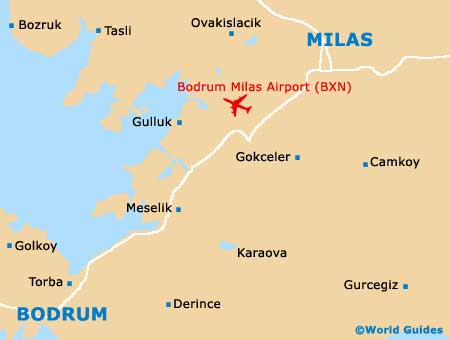
The Turkish port town of Bodrum is located within the Mugla Province in Turkey's south-westerly Aegean Region, where it lies on the southerly shoreline of the Bodrum Peninsula, next to both the Aegean Sea and the Gulf of Gokova. Also particularly close to the island of Kos (Greece), the town overlooks twin bays and its modern Inner Harbour is where you will find the Karada Marina.
The Neyzen Tevfik Caddesi is an important thoroughfare in Bodrum and runs alongside the Inner Harbour, connecting the marina with the town's famous castle (Castle of St. Peter) and providing an important area for those arriving with yachting on their mind.
Maps and Orientation of the Town
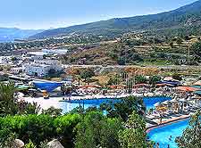
Around 40,000 people now call Bodrum their home and the town continues to slowly and steadily grow in size. Downtown Bodrum is rather divided by the Cevat Sakir Caddesi, which ultimately leads to the Otogar marketplaces and the highway. Maps of Bodrum are available from the centrally located tourist office, which resides on the main square of Iskele Meydani.
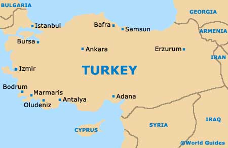
- Antalya - south-east
- Ankara - north-east
- Aydin - north-east
- Denizli - north-east
- Fethiye - south-east
- Istanbul - north
- Izmir - north
- Kusadasi - north
- Marmaris - south-east
- Milas - north-east
- Mugla - east
- Odemis - north-east
- Selcuk - north
- Soke - north
- Tire - north-east
- Turgutlu - north
- Kalymnos (Greece) - west
- Kos (Greece) - south-west
- Rhodes (Greece) - south-east
- Simi (Greece) - south-east
Map of Turkey
Map of Bodrum