Marmaris Maps and Orientation
(Marmaris, Mugla Province, Turkey)
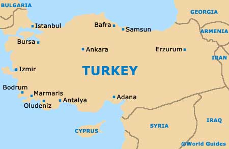
Marmaris lies in the south-west Mugla region of Turkey, at the base of the Datca Peninsula and a long way from both
Istanbul and
Ankara, approximately midway between the larger resorts of
Bodrum and Fethiye. Access overland is fairly tough on account of the rugged landscape and coast.
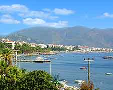
The city is diverse and sits at the head of a sizeable bay, with a manmade beach, a stunning harbour and marina. Marmaris has an Old Town and a more modern section along with a pleasant waterfront, and is fairly compact with oodles of streets. Investing in a map is a good idea.
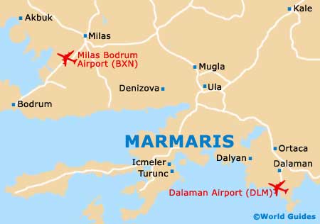
Maps and Orientation of the City
The seafront of Marmaris is the main focus of the city and stretches right around to the neighbouring resort of Icmeler, a few kilometres to the south. The Old Town also sits on the water's edge and has been built up around an ancient fort, being a pedestrianised area within reach of the Netsel Marina on foot.
Maps of Marmaris can be obtained from the tourist information office near the ferry pier.
- Antalya - 323 km / 200 miles (five hours and 30 minutes, east)
- Bodrum - 165 km / 103 miles (two hours and 45 minutes, north-west)
- Dalyan - 85 km / 53 miles (one hour and 40 minutes, east)
- Datca - 69 km / 43 miles (one hour and 20 minutes, south-west)
- Fethiye - 128 km / 80 miles (two hours and 20 minutes, south-east)
- Icmeler - 8 km / 5 miles (20 minutes, south-west)
- Izmir - 273 km / 170 miles (four hours, north-west)
- Mugla - 56 km / 35 miles (one hour, north)
- Oludeniz - 138 km / 86 miles (two hours and 40 minutes, south-east)
- Turunc - 20 km / 12 miles (35 minutes, south-west)
Map of Turkey
Map of Marmaris