Milan Maps and Orientation
(Milan, Lombardy, Italy)
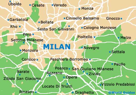
The city of Milan (Milano in Italian) is situated within Lombardy region, in the province of the same name. Milan resides in northern Italy, where it is the regional capital and borders the Province of Monza and Brianza.
A leading financial city, Milan enjoys much wealth and prosperity, with the majority of its most visited attractions being based within the area between the Castello Sforzesco and the cathedral. From the city's train stations, these attractions can be easily reached by using the underground train network, known locally as the Metropolitana Milanese (MM).
Maps and Orientation of the City
Lying on the northern side of the cathedral, the Brera district is rich in culture and home to more than its fair share of related attractions, such as art galleries. Brera is also known for its cluster of fashion boutiques and acclaimed shopping streets, while to the south is the Navigli area, where the nightlife is renowned. Tourists may also like to head to the northern side of the city, where the trendy Corso Como clubs reside, within the Porta Garibaldi area.
For tourist information and maps about Milan, consider the outlets located at the Linate and Malpensa airports, as well as at the Stazione Centrale (Central Train Station).
- Alessandria - 90 km / 56 miles (one hour and 20 minutes, south-west)
- Bologna - 219 km / 136 miles (three hours, south-east)
- Busto Arsizio - 39 km / 24 miles (50 minutes, north-west)
- Casale Monferrato - 103 km / 64 miles (one hour and 25 minutes, south-west)
- Como - 53 km / 33 miles (one hour, north)
- Cremona - 101 km / 63 miles (one hour and 25 minutes, south-east)
- Genoa - 140 km / 87 miles (one hour and 45 minutes, south)
- Ivrea - 117 km / 73 miles (one hour and 30 minutes, west)
- La Spezia - 223 km / 139 miles (three hours, south-east)
- Massa - 240 km / 149 miles (three hours and 15 minutes, south-east)
- Parma - 125 km / 78 miles (one hour and 30 minutes, south-east)
- Pavia - 41 km / 25 miles (50 minutes, south)
- Turin - 142 km / 88 miles (one hour and 50 minutes, west)
- Verona - 161 km / 100 miles (two hours, east)
- Vigevano - 35 km / 22 miles (45 minutes, south-west)
Map of Italy

Map of Milan