Rimini Maps and Orientation
(Rimini, Emilia-Romagna, Italy)
Rimini is an appealing coastal city and lies within the Emilia-Romagna area and next to the Adriatic Sea. Over the year, Rimini has grown into a thriving holiday resort and tourists flock here every summer in their droves to enjoy to sun, sand and scenery.
The Lungomare Claudio Tintori is a particularly notable coastal road in Rimini and joins the Lungomare Augusto Murri at the Piazzale Kennedy, which in turn heads towards nearby locations such as Aquafán, Le Cocoricò, Ottremare and Riccione. Those arriving by train will find the railway station on the northerly side of Rimini's historic quarter and close to the Corso Giovanni XXIII, while the Provincial Bus Station is to be found at the intersection of the Via Clementini and the Viale Roma.
Maps and Orientation of the City
A number of notable attractions and amenities lie off the Corso d'Augusto and to the south-west of the railway station. These include two of the most noteworthy public squares in Rimini, the Piazza Cavour and also the Piazza Tre Martiri, where a selection of popular restaurants await. Rimini's busy Piazza Malatesta is also close by and worth a look.
- Cesena - 38 km / 24 miles (30 minutes, north-west)
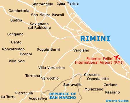
- Coriano - 13 km / 8 miles (15 minutes, south)
- Forli - 56 km / 35 miles (50 minutes, north-west)
- Gabicce Mare - 26 km / 16 miles (25 minutes, south-east)
- Longiano - 27 km / 17 miles (25 minutes, west)
- Morciano di Romagna - 29 km / 18 miles (30 minutes, south)
- Pozzi - 8 km / 5 miles (12 minutes, south)
- Riccione - 14 km / 9 miles (16 minutes, south-east)
- San Marino - 24 km / 15 miles (25 minutes, south-west)
- San Mauro Pascoli - 21 km / 13 miles (25 minutes, north-west)
- Santarcangelo di Romagna - 13 km / 8 miles (15 minutes, west)
- Verucchio - 21 km / 13 miles (25 minutes, south-west)
Map of Italy

Map of Rimini