Bologna Maps and Orientation
(Bologna, Emilia-Romagna, Italy)
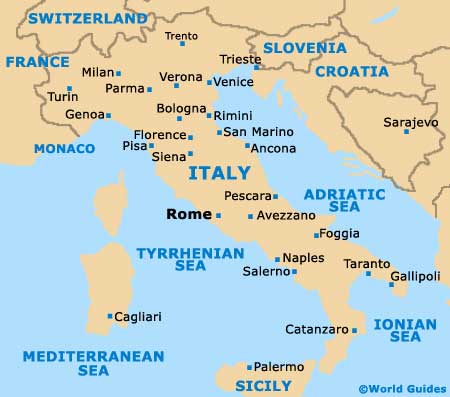
Located in Northern Italy, Bologna is the capital of the affluent Emilia-Romagna region, being famed for its Bolognese cuisine, terracotta roofs and historic university. The historic core of the city remains well-preserved, contrasting with the outlying high-tech businesses and trade-fair venues.
Central Bologna is best explored on foot, with many of the principal attractions being within comfortable walking distance of each other. The main north / south thoroughfare is the Via dell'Indipendenza, which connects both the bus and railway stations. From here, you can walk to public plazas such as the Piazza Maggiore and the Piazza del Nettuno, where many splendid medieval buildings and Renaissance-style monuments reside.
Maps and Orientation of the City
A number of tourism outlets are located within central Bologna, such as the ArciGay il Cassero on the Via Don Minzoni. On the Piazza Maggiore are both the official tourist office and the Centro Servizi per i Turisti, where maps of the city and surrounding suburbs can be picked up.
Many of the following routes feature Italian roll tolls:
- Ferrara - 53 km / 33 miles (55 minutes, north-east)
- Florence - 117 km / 73 miles (one hour and 30 minutes, south)
- Genoa - 301 km / 187 miles (four hours, west)
- Leghorn (Livorno) - 202 km / 126 miles (two hours and 55 minutes, south-west)
- Milan - 219 km / 136 miles (three hours, north-west)
- Modena - 51 km / 32 miles (55 minutes, west)
- Padua - 119 km / 74 miles (one hour and 35 minutes, north-east)
- Pisa - 182 km / 113 miles (two hours and 50 minutes, south-west)
- Prato - 104 km / 65 miles (one hour and 15 minutes, south)
- Ravenna - 75 km / 47 miles (one hour and 15 minutes, east)
- Reggio - 76 km / 47 miles (one hour and 15 minutes, west)
- Rimini - 117 km / 73 miles (one hour and 35 minutes, south-east)
- San Marino - 130 km / 81 miles (one hour and 50 minutes, south-east)
- Siena - 171 km / 106 miles (two hours and 45 minutes, south)
- Venice (includes ferry) - 159 km / 99 miles (two hours and 15 minutes, north-east)
- Verona - 151 km / 94 miles (two hours and ten minutes, north-west)
Map of Italy

Map of Bologna


