Dingle Maps and Orientation
(Dingle, County Kerry, Republic of Ireland)
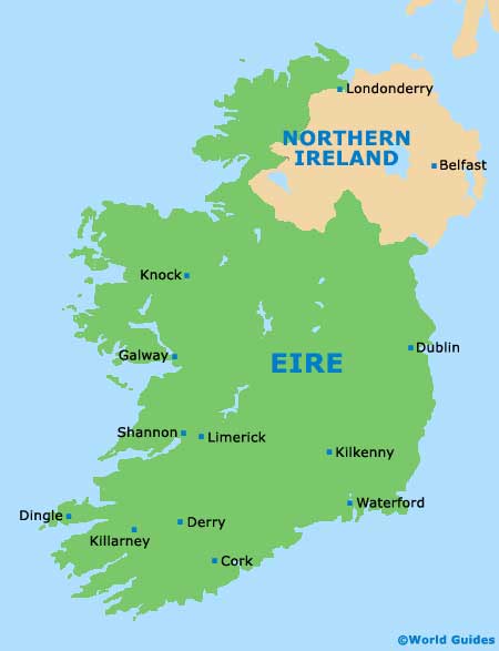
Dingle is right down in south-west
Ireland, on the southern coast of the Dingle Peninsula. It resides in County Kerry, roughly 60 km / 37 miles to the west of
Killarney, and is the gateway to the westernmost peninsula in Ireland.
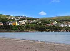
The town sits at the head of a sizeable harbour, which is well sheltered and backed by a series of medium-sized hills. It provides easy access to the rest of the Dingle Peninsula and is also close to popular villages in the region.
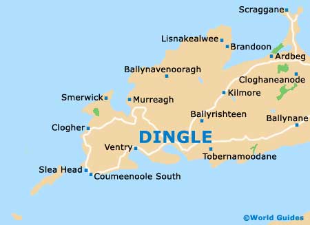
Maps and Orientation of the Town
Dingle is only a couple of kilometres end to end from a tourist's point of view and is all about the harbour and three or four nearby streets. The Strand, the Wood and Dykegate Street connect the harbour with Main Street and John Street, where much of the action is centred.
Dingle is home to just over a couple of thousand people, although it is the main town of the peninsula and thus serves a much larger number. Dingle maps are best obtained at the Tourist Office on Main Street while in the town.
- Ballyferriter - 13 km / 7 miles (15 minutes, north-west)
- Castlegregory - 25 km / 15 miles (30 minutes, north-east)
- Cork - 150 km / 94 miles (two hours and 30 minutes, south-east)
- Derry - 345 km / 214 miles (four hours and 30 minutes, north-east)
- Dunbeg Fort - 13 km / 8 miles (15 minutes, south-west)
- Killarney - 66 km / 41 miles (one hour and ten minutes, east)
- Killarney National Park - 78 km / 49 miles (one hour and 20 minutes, east)
- Limerick - 153 km / 95 miles (two hours and 20 minutes, north-east)
- Tralee - 52 km / 32 miles (50 minutes, north-east)
- Slea Head - 16 km / 10 miles (20 minutes, west)
- Western Dingle loop - 45 km / 28 miles (one hour, north-west)
Map of the United Kingdom

Map of Ireland
Map of Dingle