Worcester Maps and Orientation
(Worcester, Worcestershire, England, UK)

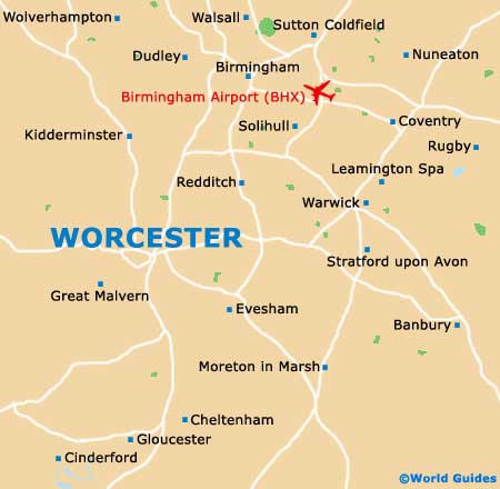
Worcestershire's county town, the city of Worcester is located in the West Midlands region of
England, where it is just a relatively short drive away from some famous British cities, such as
Birmingham,
Cheltenham, Gloucester and
Stratford upon Avon. Worcester itself is divided into two main areas by the River Severn, which runs through the very heart of the city and alongside its majestic cathedral.
The centre of Worcester is to be found on the easterly side of the River Severn, being filled with places of interest, shops and restaurants, while to the west is Cripplegate Park and the Worcestershire County Cricket Ground. In the city centre, New Street and Friar Street merge to become an important thoroughfare, heading in a north to south direction and lined with attractions.
Maps and Orientation of the City
Within the Guildhall, the city's Tourist Information Centre is a good place to obtain free maps and brochures. If you are planning to properly explore the city, then do come here and pick up the official 'Worcester Map and Guide'. This leaflet folds up to become pocket-size and includes a large map of the city centre, with an extensive key clearly marking the location of the attractions, historic buildings, galleries, exhibition spaces, sporting and entertainment venues, shopping centres, walks and parks, all of which are clearly numbered.
- Bewdley - 24 km / 15 miles (30 minutes, north)
- Birmingham - 58 km / 36 miles (one hour, north-east)
- Broadway - 35 km / 22 miles (35 minutes, south-east)
- Bromsgrove - 26 km / 16 miles (30 minutes, north-east)
- Cheltenham - 40 km / 25 miles (40 minutes, south)
- Chipping Norton - 62 km / 39 miles (one hour, south-east)
- Coventry - 75 km / 47 miles (one hour and 15 minutes, north-east)
- Dudley - 50 km / 31 miles (45 minutes, north)
- Evesham - 26 km / 16 miles (30 minutes, south-east)
- Gloucester - 46 km / 29 miles (45 minutes, south)
- Great Malvern - 13 km / 8 miles (20 minutes, south-west)
- Kidderminster - 24 km / 15 miles (30 minutes, north)
- Leamington Spa - 70 km / 44 miles (one hour and five minutes, north-east)
- Ledbury - 29 km / 18 miles (35 minutes, south-west)
- Malvern - 14 km / 9 miles (20 minutes, south-west)
- Nuneaton - 85 km / 53 miles (one hour and 20 minutes, north-east)
- Oxford - 136 km / 85 miles (one hour and 55 minutes, south-east)
- Redditch - 42 km / 26 miles (40 minutes, north-east)
- Solihull - 54 km / 34 miles (50 minutes, north-east)
- Stourport on Severn - 19 km / 12 miles (25 minutes, north)
- Stoke on Trent - 114 km / 71 miles (one hour and 40 minutes, north)
- Stratford upon Avon - 40 km / 25 miles (40 minutes, south-east)
- Sutton Coldfield - 70 km / 44 miles (one hour and five minutes, north-east)
- Tenbury Wells - 32 km / 20 miles (35 minutes, north-east)
- Upton upon Severn - 16 km / 10 miles (22 minutes, north)
- Walsall - 62 km / 39 miles (one hour, north-east)
- Wolverhampton - 59 km / 37 miles (55 minutes, north)
Map of the United Kingdom

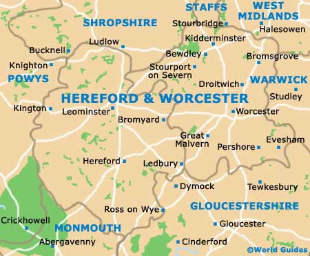
Map of Worcestershire
Map of Worcester