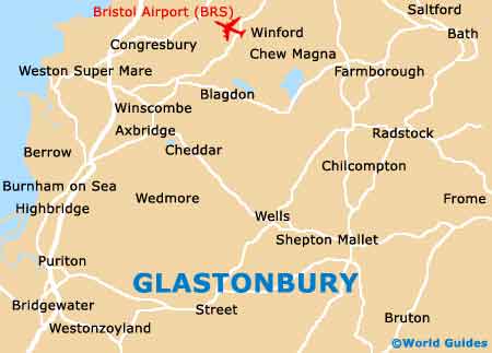
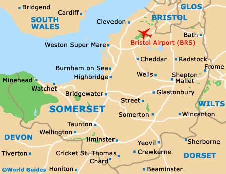
Glastonbury Maps and Orientation
(Glastonbury, Somerset, England, UK)
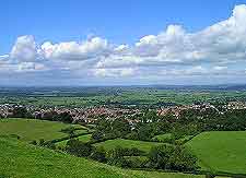
An interesting town in south-western
England, Glastonbury stands within the county of Somerset and is just a relatively short drive away from some of the region's biggest and most popular tourist cities, such as both
Bath and
Bristol, both of which are less than an hours' drive away.
Since Glastonbury is such a small town, many people simply drive through, often on their way to shop at the nearby Clark's Village complex in Street. However, if you park up and take a stroll around central Glastonbury, you will find some interesting sights and shops, particularly along the High Street.
Maps and Orientation of the Town
It is along the busy High Street where the Glastonbury Tourist Information Centre (TIC) is to be found, in the Tribunal building. The TIC is open daily during the summer months (closed on Sundays in the winter) and is a good place to pick up free maps and listings of local accommodation, and it also sells the popular Glastonbury Town Trail, where a series of local walks are mapped out and suggested.
The main bus stop is situated in central Glastonbury and stands alongside the Town Hall, on Magdalene Street, where it is especially close to the Market Cross and the famous remains of
Glastonbury Abbey.
- Bath - 42 km / 26 miles (55 minutes, north-east)
- Bournemouth - 107 km / 67 miles (one hour and 40 minutes, south-east)
- Bridgwater - 24 km / 15 miles (30 minutes, west)
- Bristol - 43 km / 27 miles (55 minutes, north)
- Castle Cary - 24 km / 15 miles (25 minutes, south-east)
- Cheddar - 21 km / 13 miles (25 minutes, north-west)
- Chippenham - 70 km / 44 miles (one hour and 20 minutes, north-east)
- Exmoor National Park - 67 km / 42 miles (one hour and 20 minutes, west)
- Frome - 34 km / 21 miles (40 minutes, north-east)
- Radstock - 30 km / 19 miles (40 minutes, north-east
- Salisbury - 88 km / 55 miles (one hour and 20 minutes, south-east)
- Shepton Mallet - 14 km / 9 miles (20 minutes, north-east)
- Sherborne - 32 km / 20 miles (40 minutes, south)
- Southampton - 126 km / 79 miles (two hours, south-east)
- Street - 3 km / 2 miles (five minutes, south)
- Swindon - 106 km / 66 miles (one hour and 40 minutes, north-east
- Taunton - 35 km / 22 miles (45 minutes, south-west)
- Wells - 10 km / 6 miles (15 minutes, north-east)
- Weston Super Mare - 35 km / 22 miles (45 minutes, north-west)
- Weymouth - 75 km / 47 miles (one hour and 25 minutes, south)
- Yeovil - 30 km / 19 miles (35 minutes, south)
Map of the United Kingdom

Map of Somerset
Map of Glastonbury