Exeter Maps and Orientation
(Exeter, Devon, England, UK)
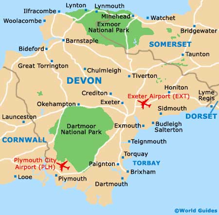
Located in the far south-west of
England and within driving distance of the Cornwall border, which is just over 64 km / 40 miles away, Exeter lies within the spreading county of Devon. The university city of Exeter stands directly to the east of the Dartmoor National Park and has a population of around 130,000 people.
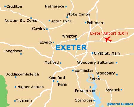
Central Exeter is quite compact and its size and general layout make sightseeing very straightforward. The main places of interest stand within the areas now known as the Castle Quarter, the Cathedral Quarter and the West Quarter. Also of note are the neighbourhoods of Southernhay (Southgate) and the Historic Quayside, as well as the shopping havens of Princesshay and the High Street area.
Maps and Orientation of the City
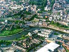
The centre of Exeter is dominated by its enormous cathedral, which is clearly visible on the skyline and stands just to the south of the castle ruins. On the southern side of the city centre is the River Exe, which is home to a vibrant redeveloped Quay area, where waterfront warehouses have been converted into shops and trendy place to eat.
For maps and brochures, the Quay House Interpretation and Visitor centre on the quayside is the place to come, as is the tourist office on Dix's Field, next to Paris Street. If you are strolling around Exeter city centre, then look out for Parliament Street, which is reputedly the narrowest street in the whole of the UK, measuring just 1.2 metres / 4 feet at the widest point.
- Axminster - 43 km / 27 miles (45 minutes, east)
- Brixham - 46 km / 29 miles (50 minutes, south)
- Budleigh Salterton - 19 km / 12 miles (25 minutes, south-east)
- Chard - 50 km / 31 miles (50 minutes, north-east)
- Clannaborough - 22 km / 14 miles (30 minutes, north-west)
- Clyst St. Mary - 10 km / 6 miles (15 minutes, east)
- Crediton - 13 km / 8 miles (15 minutes, north-west)
- Cullompton - 26 km / 16 miles (30 minutes, north)
- Dartmouth - 67 km / 42 miles (one hour, south)
- Dawlish - 21 km / 13 miles (25 minutes, south)
- Exmouth - 16 km / 10 miles (20 minutes, south)
- Holcombe Burnell - 5 km / 3 miles (ten minutes, west)
- Honiton - 27 km / 17 miles (30 minutes, east)
- Lyme Regis - 46 km / 29 miles (50 minutes, east)
- Lynton and Lynmouth - 88 km / 55 miles (one hour and 25 minutes, north)
- Newton Abbot - 27 km / 17 miles (30 minutes, south)
- Ottery St. Mary - 19 km / 12 miles (25 minutes, east)
- Paignton - 38 km / 24 miles (45 minutes, south)
- Plymouth - 70 km / 44 miles (one hour, south-west)
- Sidmouth - 26 km / 16 miles (30 minutes, east)
- Swanage - 128 km / 80 miles (two hours, east)
- Taunton - 54 km / 34 miles (50 minutes, north-east)
- Teignmouth - 24 km / 15 miles (30 minutes, south)
- Tiverton - 24 km / 15 miles (30 minutes, north)
- Torquay - 35 km / 22 miles (40 minutes, south)
Map of the United Kingdom

Map of Devon
Map of Exeter