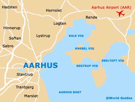
Aarhus Maps and Orientation
(Aarhus, Denmark)
Situated on Denmark's Jutland peninsula and home to the country's premier harbour, Aarhus is a large and spreading city, with a population today of just over 300,000 residents, although there are some 800,000 within its metropolitan area. Aarhus is Denmark's number two city after the capital of
Copenhagen and is a surprisingly youthful city, with over 35,000 students attending its university.
Situated within the country's geographical heart, Aarhus stands directly north of a series of forested areas, such as the Risskov, and has grown up around its busy harbour, where a popular marina has recently been added. Many sandy and rocky beaches are strewn along the Aarhus coastline, along with tall hills and an array of attractive meadows.
Maps and Orientation of the City
Aarhus city centre is generally considered to be quite compact and is not difficult to get around. The southerly side of central Aarhus is clearly denoted by the railway station (Arhus Hovedbanegard), while the very heart of the city is off the Sankt Clements Torv and the Sondergade, two especially prominent shopping streets.
The best place to find maps of the city is at the tourist office (Tourist Arhus) at the City Hall on the Park Allé, or at one of the bookshops on Frederiks Allé and the Sondergade.
- Aalborg - 119 km / 74 miles (one hour and 40 minutes, north)
- Favrskov - 32 km / 20 miles (35 minutes, north-west)
- Hadsten - 26 km / 16 miles (30 minutes, north-west)
- Herning - 88 km / 55 miles (one hour and 20 minutes, west)
- Hinnerup - 17 km / 11 miles (18 minutes, north-west)
- Holstebro - 123 km / 76 miles (one hour and 45 minutes, west)
- Horsens - 50 km / 31 miles (55 minutes, south-west)
- Lystrup - 15 km / 9 miles (15 minutes, north)
- Mariager - 65 km / 40 miles (one hour, north)
- Odense - 146 km / 91 miles (one hour and 45, south)
- Norddjurs - 77 km / 48 miles (one hour and 20 minutes, north-east)
- Randers - 40 km / 25 miles (38 minutes, north)
- Silkeborg - 48 km / 30 miles (50 minutes, west)
- Skanderborg - 26 km / 16 miles (30 minutes, south-west)
- Tranbjerg - 20 km / 12 miles (18 minutes, south-west)
- Viborg - 68 km / 42 miles (one hour and ten minutes, north-west)
Map of Denmark

Map of Aarhus